Cedar Valley Nature Trail
This information is a public record of the 1984 NRT application and may be out of date if it has not been updated by a trail manager --
check with the trail manager for updated details before visiting.
check with the trail manager for updated details before visiting.
Cedar Valley Nature Trail
City, Town, or County
Rail Trail
- Length
52 miles
- Elevation Gain
--
- Route Type
out & back
- Length
52 miles - Elevation Gain
-- - Route Type
out & back
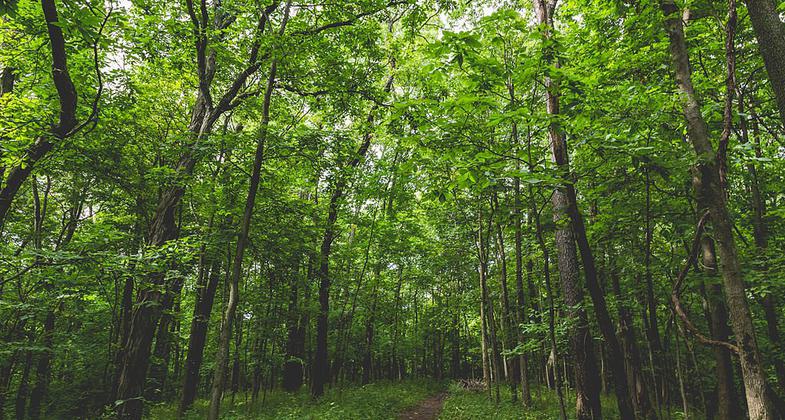
The Cedar Valley Nature Trail hiking trail at Sugar Bottom Recreation Area and campground near North Liberty, Iowa. Photo by Tony Webster.

Location: Connects the Linn County Metro area to Waterloo, IA
- States: Iowa
- Counties: Benton, Black Hawk, Buchanan, Linn
Abandoned Illinois Central Gulf railroad between Evansdale and Hiawatha. Follows Cedar River bottomlands, along forested banks of the river and rolling farmlands, broken up by stream valleys and small towns.
The Cedar Valley Nature Trail is owned and managed by two different County Conservation Boards. The northern 26 miles from Evansdale Iowa to the Benton/Buchanan County line is Black Hawk County Conservation and the southern 26 miles from the Benton/Buchanan County line to Hiawatha is Linn County Conservation.
Accessibility Information
No text provided.
Allowed Uses:
Bicycling Dogs, on leash Hiking/Walking Snow, cross-country skiing Snow, snowshoeingOther Activities
- Camping
- Fishing
- Snow, snow play general
- Wildlife viewing / observation
Public Contact
Linn-County Conservation Board10260 Morris Hills Road
Toddville, IA 52341
[email protected]
Contact the trail manager for current maps and visiting details.
More Details
- Elevation (low): --
- Elevation (high): --
- Elevation (cumulative): --
- Part of a Trail System? No
- Surface (primary): Paved
- Surfaces (additional): Rock, crushed
- Tread Width (average): 120"
- Tread Width (minimum): --
- Running length (minimum): --
- Tread Grade (average, percent): --
- Tread Grade (maximum):
- Running length (maximum): --
- Cross-slope (average, percent): --
- Cross-slope (maximum): --
- Running length (maximum): --
- Certified as an NRT
Oct 12, 1984