Catoctin Trail (Blue Trail)
check with the trail manager for updated details before visiting.
Catoctin Trail (Blue Trail)
National Park Service
Backcountry Trail
- Length
26.6 miles
- Elevation Gain
--
- Route Type
out & back
(1 review)
- Length
26.6 miles - Elevation Gain
-- - Route Type
out & back
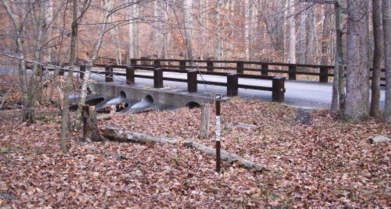
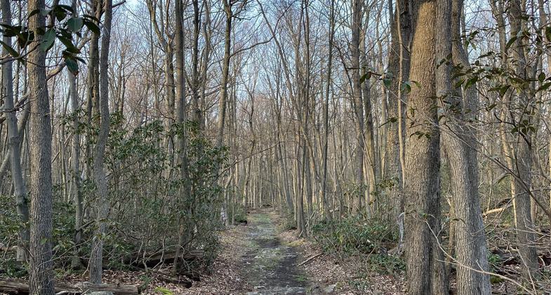
The 26 mile long Catoctin Trail is located along the eastern portion of the Blue Ridge Mountains of Western Maryland. Hikers experience stunning vistas, and freshwater streams including Maryland's largest cascading waterfall.


Location: The Catoctin Trail runs 26.6 miles along the eastern-most ridge of the Blue Ridge Mountains in Frederick County, Maryland 55 miles northwest of Washington, DC and Baltimore.
- States: Maryland
- Counties: Frederick
The Catoctin Trail is 26 miles in length and passes through one national park, two state parks, and two municipal watersheds while traversing the easternmost ridge of the Blue Ridge Mountains in Maryland. Portions of this trail were originally designed and constructed by the Works Progress Administration and the Civilian Conservation Corps in the 1930s. The Catoctin Trail provides recreation to the Towns of Thurmont and Smithsburg on the north and Frederick, Maryland on the south in addition to serving over three million visitors per year from the Washington Baltimore metropolitan area.
The trail lies within three miles of the Appalachian Trail, crosses a State Scenic Byway, and parallels the Catoctin Mountain National Scenic Byway. Along its route, there are historic districts (Camp Greentop and Camp Misty Mount) as well as historic and prehistoric archeological resources including Indian flint napping sites and Colonial-era charcoal hearths. In addition to skirting several lakes, the trail also accesses numerous scenic vistas with views of the Monocacy River Valley.
A diverse partnership of all levels of government and non-profits manages a variety of recreational uses along the trail.
Accessibility Information
No text provided.
Reviews
Bill Derbyshire
Local hiker
Best kept secret for a fun and challenging hike for all ages. Highly recommend! Beautiful wooded scenery, streams, vistas and Catoctin animal life.
Allowed Uses:
Bicycling Boating, human-powered Swimming Dogs, on leash Equestrian Hiking/Walking Snow, cross-country skiing Snow, snowshoeingOther Activities
- Camping
- Fishing
- Rock climbing
- Snow, snow play general
Public Contact
J. Mel PooleNational Park Service
6602 Foxville Road
Thurmont, MD 21788
[email protected] • (301) 663-9330
www.nps.gov/cato
More Details
- Elevation (low): 600
- Elevation (high): 1765
- Elevation (cumulative): --
- Part of a Trail System? No
- Surface (primary): Soil
- Surfaces (additional): Boardwalk, Rock, boulders, Rock, crushed, Rock, smooth, Soil
- Tread Width (average): 72"
- Tread Width (minimum): --
- Running length (minimum): --
- Tread Grade (average, percent): 6
- Tread Grade (maximum): 12
- Running length (maximum): --
- Cross-slope (average, percent): --
- Cross-slope (maximum): --
- Running length (maximum): --
- Certified as an NRT
May 19, 2011