Cascade Falls
This information is a public record of the 1979 NRT application and may be out of date if it has not been updated by a trail manager --
check with the trail manager for updated details before visiting.
check with the trail manager for updated details before visiting.
Cascade Falls
USDA Forest Service
Backcountry Trail
- Length
0.5 miles
- Elevation Gain
--
- Route Type
out & back
- Length
0.5 miles - Elevation Gain
-- - Route Type
out & back
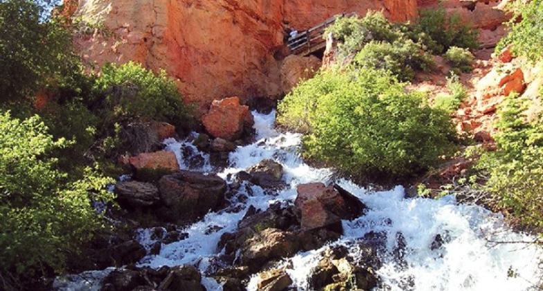
Cascade Falls just below the cave opening, forming the headwaters of the North Fork of the Virgin River. Photo by Lance Weaver, Utah Geo. Survey.

Photo by Pam Riches.

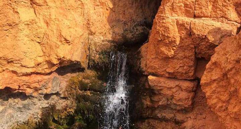
Falls coming out of the sandstone. Photo by Pam Riches.

Looking south to Zion. Photo by Pam Riches.
Location: Cedar City Ranger District, In Dixie, 35 mi. SE of Cedar City, off SR 14 on Dry Valley Rd.
- States: Utah
- Counties: Kane
Cascade Falls is a short trail with scenic views of the Virgin River headwaters and Zion National Park. Foreground views include severely eroded pink and white limestone cliff formations. The waterfall at the end of the trail spills from a cave opening on the side of the cliff. The cave is part of a network of lava tubes that partially drain Navajo Lake. The stream is part of the headwaters of the Virgin River responsible for the formation of Zion Canyon.
Accessibility Information
No text provided.
Allowed Uses:
Dogs, on leash Hiking/WalkingOther Activities
- Wildlife viewing / observation
Public Contact
Kent TravellerDixie National Forest
Cedar City Ranger District.
Cedar City, UT 84720
[email protected] • (435) 865-3200
Contact the trail manager for current maps and visiting details.
More Details
- Elevation (low): 8800
- Elevation (high): 8900
- Elevation (cumulative): --
- Part of a Trail System? No
- Surface (primary): Soil
- Surfaces (additional): Soil
- Tread Width (average): 42"
- Tread Width (minimum): --
- Running length (minimum): --
- Tread Grade (average, percent): 5
- Tread Grade (maximum): 20
- Running length (maximum): --
- Cross-slope (average, percent): --
- Cross-slope (maximum): --
- Running length (maximum): --
- Certified as an NRT
Nov 15, 1979