Carson Emigrant Historic Trail
This information is a public record of the 1980 NRT application and may be out of date if it has not been updated by a trail manager --
check with the trail manager for updated details before visiting.
check with the trail manager for updated details before visiting.
Carson Emigrant Historic Trail
USDA Forest Service
Backcountry Trail
- Length
15 miles
- Elevation Gain
--
- Route Type
out & back
- Length
15 miles - Elevation Gain
-- - Route Type
out & back
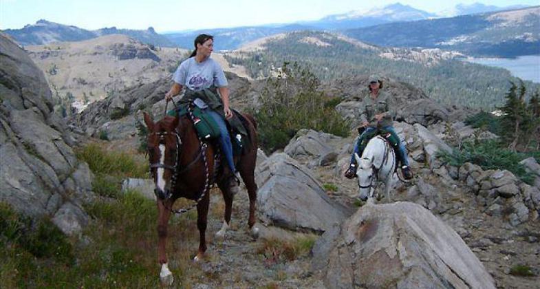
Photo by Kimberli Fish.

Covered Wagon Peak taken from Squaw Ridge. Photo by Kimberli Fish.
Location: Caples Lake Dam parking area.
- States: California
- Counties: El Dorado
This trail follows one of the original emigrant routes across the rugged Sierra Nevada's. The trail passes by Hope Valley, Carson Pass, Covered Wagon Peak, Silver Lake, and Tragedy Springs. Ruts from the original wagons are still there to see and feel.
Accessibility Information
No text provided.
Allowed Uses:
Hiking/Walking Motorized vehicles, snowmobilingOther Activities
- Camping
- Snow, snow play general
Public Contact
Lester LubetkinEl Dorado National Forest
100 Forni Rd.
Placerville, CA 95667
(530) 622-5061
Contact the trail manager for current maps and visiting details.
More Details
- Elevation (low): --
- Elevation (high): --
- Elevation (cumulative): --
- Part of a Trail System? No
- Surface (primary): --
- Surfaces (additional): --
- Tread Width (average): 24"
- Tread Width (minimum): --
- Running length (minimum): --
- Tread Grade (average, percent): --
- Tread Grade (maximum):
- Running length (maximum): --
- Cross-slope (average, percent): --
- Cross-slope (maximum): --
- Running length (maximum): --
- Certified as an NRT
May 5, 1980