Calumet Trail
check with the trail manager for updated details before visiting.
Calumet Trail
National Park Service
Rail Trail
- Length
9.2 miles
- Elevation Gain
--
- Route Type
out & back
- Length
9.2 miles - Elevation Gain
-- - Route Type
out & back
9.5 miles one-way, 23 feet of elevation gain, 0% average grade, 1% maximum grade. Average time: 1.5 hours.
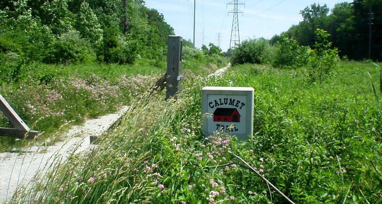
Location: Connects Dune Shores to Michigan City along a utility corridor by the southern boundary of Indian Dunes National Lakeshore.
- States: Indiana
The trail follows the South Shore Railroad tracks and NIPSCO power lines. There is no shade. The trail can be impassible (i.e. wet shoes) due to standing water along much of the trail that can be 4-6" deep in spots. The trail is not suitable for road bikes.
The Calumet Trail connects to many trail systems. The west trailhead parking lot connects to the Porter Brickyard Trail and the Cowles Bog Trail System (no bikes allowed). There is access to the Dunes Kankakee Trail and Indiana Dunes State Park trail system at the South Shore Dunes Park train station. At East State Park Road (Kemil Road or 300E), there is access across U.S. Highway 12 to the Glenwood Dunes Trail System (no bikes allowed) and the Calumet Dunes Trail (no bikes allowed). At Broadway Avenue (Beverly Shores), there is access to the Great Marsh Trail (no bikes allowed) and the Dunewood Campground. At the east trailhead, the parking lot on U.S. Highway 12 is close to the Mount Baldy Trail System.
Accessibility Information
No text provided.
Allowed Uses:
Bicycling Hiking/WalkingPublic Contact
Indiana Dunes National Park1100 North Mineral Springs Road
Porter, IN 46304
(219) 395-1882
www.nps.gov/indu/planyourvisit/calumet.htm
More Details
- Elevation (low): --
- Elevation (high): --
- Elevation (cumulative): --
- Part of a Trail System? No
- Surface (primary): --
- Surfaces (additional): --
- Tread Width (average): 0"
- Tread Width (minimum): --
- Running length (minimum): --
- Tread Grade (average, percent): --
- Tread Grade (maximum):
- Running length (maximum): --
- Cross-slope (average, percent): --
- Cross-slope (maximum): --
- Running length (maximum): --
- Certified as an NRT
May 31, 1976