Calico
This information is a public record of the 1979 NRT application and may be out of date if it has not been updated by a trail manager --
check with the trail manager for updated details before visiting.
check with the trail manager for updated details before visiting.
Calico
USDA Forest Service
Backcountry Trail
- Length
22 miles
- Elevation Gain
--
- Route Type
out & back
- Length
22 miles - Elevation Gain
-- - Route Type
out & back
Calico Trail offers 22 miles of challenging single-track.
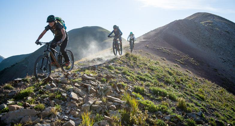
A 15% average grade that challenges endurance. Photo by www.uncovercolorado.com.
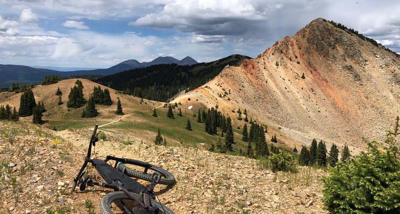
Magic in the mountains. Photo by Jordan Carr.
Location: San Juan National Forest, In San Juan National Forest on Forest Rd. 471, 4 mi. from SR 145.
- States: Colorado
- Counties: Dolores, Montezuma
The Calico is a multiple-use trail with primary users being trail motorcyclists, equestrians, hikers, and mountain bikers. The trail is ridge line and climbs several peaks, offering spectacular vistas of the La Plata and San Juan Mountain Ranges.
Accessibility Information
No text provided.
Allowed Uses:
Bicycling Dogs, on leash Equestrian Hiking/Walking Motorized vehicles, motorcyclingOther Activities
- Camping
Public Contact
Lloyd McNeilSan Juan National Forest
Dolores Ranger District
Dolores, CO 81323
[email protected] • (970) 882-7296
Contact the trail manager for current maps and visiting details.
More Details
- Elevation (low): 8500
- Elevation (high): 12340
- Elevation (cumulative): --
- Part of a Trail System? No
- Surface (primary): Soil
- Surfaces (additional): Soil
- Tread Width (average): 18"
- Tread Width (minimum): --
- Running length (minimum): --
- Tread Grade (average, percent): 15
- Tread Grade (maximum): 25
- Running length (maximum): --
- Cross-slope (average, percent): --
- Cross-slope (maximum): --
- Running length (maximum): --
- Certified as an NRT
Nov 15, 1979