Caberfae Way Snowmobile
This information is a public record of the 1978 NRT application and may be out of date if it has not been updated by a trail manager --
check with the trail manager for updated details before visiting.
check with the trail manager for updated details before visiting.
Caberfae Way Snowmobile
USDA Forest Service
Backcountry Trail
- Length
36 miles
- Elevation Gain
--
- Route Type
out & back
- Length
36 miles - Elevation Gain
-- - Route Type
out & back
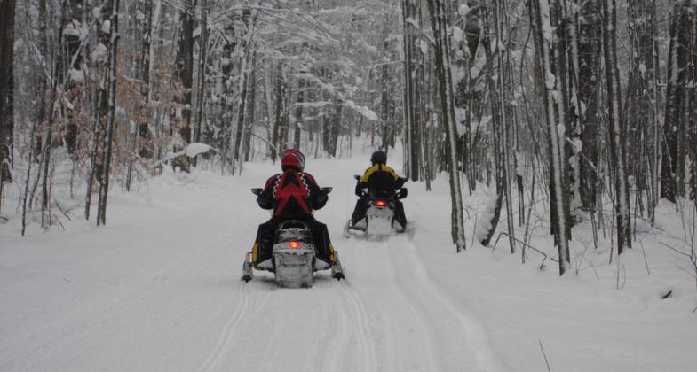
Snowmobilers enjoying fresh snow on this 200 mile trail!. Photo by cadillacmichigan.com.
Location: Joins Cadillac to Mesick through Manistee National Forest.
- States: Michigan
Adventure seekers will love to explore the greater Cadillac area via snowmobile. This opportunity is perfect for the family or for groups that want an exciting vacation! The trail system is exceptional and well groomed. The Cadillac area has a vast trail system that spreads through the Huron Manistee National Forest with over 200 miles of groomed trails.
Accessibility Information
No text provided.
Allowed Uses:
Motorized vehicles, snowmobilingOther Activities
- Snow, snow play general
Public Contact
Huron-Manistee National Forests1755 South Mitchell St.
Cadillac, MI 49601
Contact the trail manager for current maps and visiting details.
More Details
- Elevation (low): --
- Elevation (high): --
- Elevation (cumulative): --
- Part of a Trail System? No
- Surface (primary): Snow or ice
- Surfaces (additional): --
- Tread Width (average): 0"
- Tread Width (minimum): --
- Running length (minimum): --
- Tread Grade (average, percent): --
- Tread Grade (maximum):
- Running length (maximum): --
- Cross-slope (average, percent): --
- Cross-slope (maximum): --
- Running length (maximum): --
- Certified as an NRT
Dec 7, 1978