Bronx River Blueway
check with the trail manager for updated details before visiting.
Bronx River Blueway
Nonprofit
National Water Trail
- Length
8 miles
- Elevation Gain
--
- Route Type
out & back
- Length
8 miles - Elevation Gain
-- - Route Type
out & back
The Bronx River watertrail extends eight miles from Shoelace Park near 219th Street to Soundview Park at the estuary to Long Island Sound.
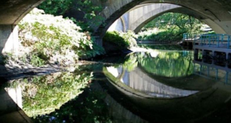

Location: The watertrail extends eight miles from Shoelace Park on East 219th Street to Soundview Park at the East River. The Bronx River is a unique and interesting way to explore the only freshwater river in New York City.
- States: New York
- Counties: Bronx
- Cities/Townships: New York City
The Bronx River, the only freshwater river in New York City, offers a variety of recreational and cultural opportunities, passing directly through the New York Botanical Gardens, the Bronx River Forest, cityscapes, and the Bronx Zoo, which gives paddlers an excellent view of the Bison enclosure. The water trail offers abundant signage and ample access, with a total of nine launch sites along eight miles of the trail. The trail is managed by New York City Parks and The Bronx River Alliance, which maintains a high-quality, bi-lingual website with interactive river and watershed information, including maps, a link to the Bronx River Management Plan, a full calendar of events which includes a river festival and flotilla, and many more visitor resources. The water trail is suitable for those at novice to expert level. The trail attracts nearly 15,000 people to the river per year, many of whom have never experienced a water trail before.
Accessibility Information
No text provided.
Allowed Uses:
Boating, human-poweredPublic Contact
Linda CoxBronx River Alliance
1 Bronx River Parkway
Bronx, NY 10462
[email protected] • (718) 430-4668
More Details
- Elevation (low): --
- Elevation (high): --
- Elevation (cumulative): --
- Part of a Trail System? No
- Surface (primary): Water, slow moving
- Surfaces (additional): --
- Tread Width (average): 0"
- Tread Width (minimum): 0
- Running length (minimum): --
- Tread Grade (average, percent): --
- Tread Grade (maximum):
- Running length (maximum): --
- Cross-slope (average, percent): 0
- Cross-slope (maximum): --
- Running length (maximum): --
- Certified as an NRT
May 21, 2012