Bridger Foothills
check with the trail manager for updated details before visiting.
Bridger Foothills
USDA Forest Service
Backcountry Trail
- Length
20.2 miles
- Elevation Gain
--
- Route Type
out & back
- Length
20.2 miles - Elevation Gain
-- - Route Type
out & back
Popular foothills trail that connects to Bozeman community trails. Offers many scenic overlook in roughed backcountry setting.
Location: West Bridger Mountain Range, no. of Bozeman, MT
- States: Montana
- Counties: Gallatin
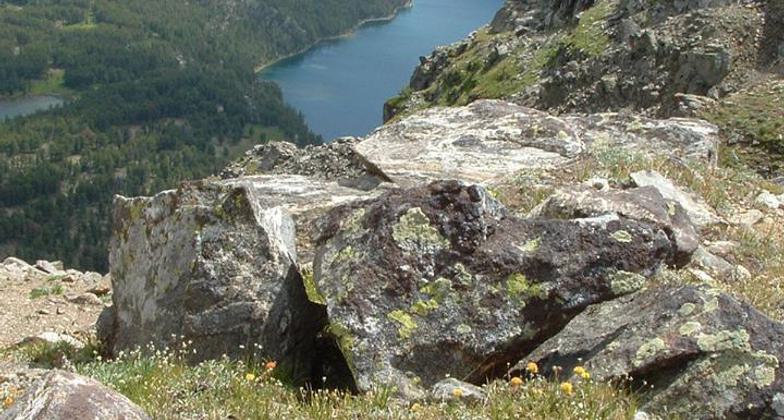
This National Recreation Trail traverses nearly the entire length of the Bridger Mountain Range and offers hikers long views of the Gallatin Valley, The Tobacco Root Mountains, the Madison Range, the Gallatin Range, and the towns of Bozeman and Belgrade.
The Foothills Trail is not for the faint of heart nor for a hiker fearing massive elevation gain and loss. The trail follows the myriad of coulees that make up the west side of the Bridger Mountains and the trail goes up and down into each and every single one of them. The trail dips into a little draw only to immediately take you back up and out of it giving you a glimpse just a bit farther down the valley.
The long traversing nature of the trail means that it crosses many other trails and most hikers will find its primary use is to simply connect two of these together. A popular mountain bike route is to connect the Sypes Canyon Trail with the College M Trail via the Foothills Trail. Other options are Corbly Gulch and Middle Cottonwood as well.
Accessibility Information
No text provided.
Allowed Uses:
Bicycling Dogs, on leash Equestrian Hiking/WalkingOther Activities
- Camping
Public Contact
Brian McNeilUS Forest Service
3710 Fallon St., Suite C
Bozeman, MT 59718
[email protected] • (406) 522-2520
www.fs.fed.us/r1/gallatin
Contact the trail manager for current maps and visiting details.
More Details
- Elevation (low): 5000
- Elevation (high): 7500
- Elevation (cumulative): --
- Part of a Trail System? No
- Surface (primary): Soil
- Surfaces (additional): Soil
- Tread Width (average): 24"
- Tread Width (minimum): --
- Running length (minimum): --
- Tread Grade (average, percent): 15
- Tread Grade (maximum): 40
- Running length (maximum): --
- Cross-slope (average, percent): --
- Cross-slope (maximum): --
- Running length (maximum): --
- Certified as an NRT
Dec 17, 1978