Boundary Trail - Kangaroo Segment
This information is a public record of the 1979 NRT application and may be out of date if it has not been updated by a trail manager --
check with the trail manager for updated details before visiting.
check with the trail manager for updated details before visiting.
Boundary Trail - Kangaroo Segment
USDA Forest Service
Backcountry Trail
- Length
7.9 miles
- Elevation Gain
--
- Route Type
out & back
- Length
7.9 miles - Elevation Gain
-- - Route Type
out & back
Location: Backcountry/Wilderness
- States: California
- Counties: Siskiyou
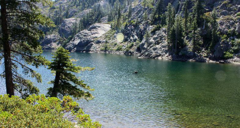
This trail provides spectacular views of the Red Butte and surrounding mountains. Southern exposure near the ridge top, good views, rough country, lots of rock and brush.
Accessibility Information
No text provided.
Allowed Uses:
Bicycling Dogs, on leash Equestrian Hiking/Walking Snow, cross-country skiing Snow, snowshoeingOther Activities
- Camping
- Snow, snow play general
- Wildlife viewing / observation
Public Contact
Patrick GarrahanUSFS-Happy Camp Ranger District.
P.O. Box 377
Happy Camp, CA 96039
[email protected] • (530) 493-1718
Contact the trail manager for current maps and visiting details.
More Details
- Elevation (low): 4000
- Elevation (high): 5200
- Elevation (cumulative): --
- Part of a Trail System? No
- Surface (primary): Soil
- Surfaces (additional): Soil
- Tread Width (average): 24"
- Tread Width (minimum): --
- Running length (minimum): --
- Tread Grade (average, percent): 7
- Tread Grade (maximum): 15
- Running length (maximum): --
- Cross-slope (average, percent): --
- Cross-slope (maximum): --
- Running length (maximum): --
- Certified as an NRT
Dec 12, 1979