Blue Mountain Equestrian Trail
This information is a public record of the 1978 NRT application and may be out of date if it has not been updated by a trail manager --
check with the trail manager for updated details before visiting.
check with the trail manager for updated details before visiting.
Blue Mountain Equestrian Trail
USDA Forest Service
Backcountry Trail
- Length
9.1 miles
- Elevation Gain
--
- Route Type
out & back
- Length
9.1 miles - Elevation Gain
-- - Route Type
out & back
Trail goes to a fire lookout.
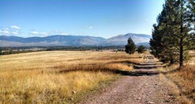
The 4,900-acre recreation area includes 41 miles of system equestrian trails. Photo by USFS.
Location: 15 minutes soutwest of Missoula in the Lolo National Forest.
- States: Montana
- Counties: Missoula
Trail goes to a fire lookout.
Accessibility Information
No text provided.
Allowed Uses:
Swimming Dogs, on leash EquestrianOther Activities
- Camping
- Wildlife viewing / observation
Public Contact
Missoula Ranger DistrictBldg 24, Ft. Missoula
Missoula, MT 59804
[email protected] • (406) 329-3984
Contact the trail manager for current maps and visiting details.
More Details
- Elevation (low): 3200
- Elevation (high): 6400
- Elevation (cumulative): --
- Part of a Trail System? No
- Surface (primary): Soil
- Surfaces (additional): Soil
- Tread Width (average): 18"
- Tread Width (minimum): --
- Running length (minimum): --
- Tread Grade (average, percent): 12
- Tread Grade (maximum): 20
- Running length (maximum): --
- Cross-slope (average, percent): --
- Cross-slope (maximum): --
- Running length (maximum): --
- Certified as an NRT
Apr 20, 1978