Blue Hill Hiking Trail
check with the trail manager for updated details before visiting.
Blue Hill Hiking Trail
U.S. Fish and Wildlife Service
Backcountry Trail
- Length
5 miles
- Elevation Gain
--
- Route Type
out & back
(1 review)
- Length
5 miles - Elevation Gain
-- - Route Type
out & back
Location: Sherburne National Wildlife Refuge, In Sherburne NWR, NW of Zimmerman, W of US 169.
- States: Minnesota
- Counties: Sherburne
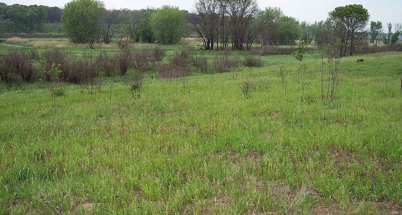
The Blue Hill Trail at Sherburne National Wildlife Refuge offers five miles of scenic hiking over moderately level terrain. Blue Hill, the highest point on the refuge, rises about 90 feet above the surrounding area. This hill of sand, rocks, and gravel is surrounded by flat to rolling sandy terrain and wetlands formed by glacial meltwater 12,000 years ago.
The oak woodland along the trail is part of the oak savanna where scattered bur oak, red oak, and American hazelnut are interspersed with prairie openings and wetlands. The oak savanna is being restored through the use of prescribed burning.
The trail has three loops designed to let the visitor choose their walking distance as they travel through woodland habitat and prairie openings, skirting Buck Lake, and several seasonal wetlands. An observation deck with a spotting scope provides an excellent view of Buck Lake.
For more information on Sherburne National Wildlife Refuge call (763) 389-3323. The refuge is located east of St. Cloud, Minnesota.
Accessibility Information
No text provided.
Reviews
Fantastic Trail for all
Always have highly enjoyable experiences here. Beautiful scenery. Barefoot friendly.
http://www.ramblefeet.com/trails/Sherburne_National_Wildlife_Refuge_Blue_Hill_Trail/Blue_Hill_Trail.html
Allowed Uses:
Hiking/WalkingOther Activities
- Wildlife viewing / observation
Public Contact
Nancy HaugenU.S. Fish & Wildlife Service
Sherburne NWR 17076 293rd Ave
Zimmerman, MN 55398
[email protected] • (763) 389-3323 ext. 13
www.fws.gov/midwest/sherburne
Contact the trail manager for current maps and visiting details.
More Details
- Elevation (low): 1000
- Elevation (high): 1090
- Elevation (cumulative): --
- Part of a Trail System? No
- Surface (primary): Grass or Vegetation
- Surfaces (additional): Grass or Vegetation
- Tread Width (average): 72"
- Tread Width (minimum): --
- Running length (minimum): --
- Tread Grade (average, percent): 2
- Tread Grade (maximum): 10
- Running length (maximum): --
- Cross-slope (average, percent): --
- Cross-slope (maximum): --
- Running length (maximum): --
- Certified as an NRT
May 31, 1981