Blevins Gap Nature Preserve Trail System
check with the trail manager for updated details before visiting.
Blevins Gap Nature Preserve Trail System
Nonprofit
Backcountry Trail
Frontcountry Trail
Urban Trail
- Length
10.5 miles
- Elevation Gain
--
- Route Type
Loop
- Length
10.5 miles - Elevation Gain
-- - Route Type
Loop
Blevins Gap Nature Preserve is 971.12 acres of scenic vistas, rock overhangs, trails, and pristine forest. It features a 10.5 mile trail system composed of ten named trails and contains the southernmost remnant of the Space Walk Trail created by Boy Scouts in the 1960's. This Preserve is one of three Land Trust Preserves that are each larger than Central Park and are all within Huntsville city limits.
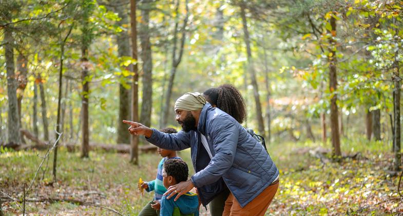
A family stops along the trail at Blevins Gap Nature Preserve to observe. Photo by Lauren Sanderson. Photo by Bob Goodwin
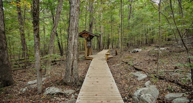
A boardwalk allows for wet-weathre access to the Fanning Trail. Photo by Lauren Sanderson.

Location: Huntsville, Alabama
- States: Alabama
- Counties: Madison
- Cities/Townships: Huntsville
Blevins Gap Nature Preserve is 971.12 acres of scenic vistas, rock overhangs, trails, and pristine forests. It features a 10.5-mile trail system. This Preserve is one of three Land Trust Preserves that are each larger than Central Park and are all within Huntsville city limits.
Called Huntsville's own Little Appalachian Trail, the Preserve contains the southernmost remnant of the Space Walk Trail created by Boy Scouts in the 1960s that ran from Monte Sano State Park to the south end of Green Mountain.
The northern portion of the Preserve holds the first piece of property donated to Alabama's first land trust (now the Land Trust of North Alabama) in 1988. These acres now feature the Stevenson and Fanning trails named for the first land donors.
A well-used trail system for passive non-motorized recreation, this Preserve is a favorite of runners, mountain bikers, and hikers. The trails are valued for their variety as well as their scenic vistas.
The Preserve is part of the Cumberland Plateau with a large sandstone mountain cap and huge sandstone bluffs. It is home to bobcats, deer, coyotes, foxes, turkeys, raccoons, opossums, and armadillos. Pockets of endangered Price's Potato Bean and Morefield's Leather Flower have been found. Also found are the American Smoketree (also called Chittamwood and once used for making yellow dye), Ovate Flycatcher, Yellow Lady Slipper, and Alabama Snow Wreath.
The Land Trust works in partnership with Alabama's Forever Wild program to manage the Preserve. Both Forever Wild and the Land Trust own land that comprises the Preserve, with the Land Trust providing management and trail development/maintenance. The Land Trust's Public Recreation Committee is responsible for identifying, prioritizing, planning, implementing, and maintaining all recreational development including trail development and trailheads on properties opened to the public. In addition, this committee works closely with the Volunteer Coordinator to recruit, develop, and nurture volunteers needed to support their efforts. This committee is also responsible for all mapping and GIS-gathering efforts.
The Land Trust offers environmental outreach programs. Seasonal hikes and events on the trails offer a gateway to use and direct enjoyment of Land Trust properties, increasing the probability of self-initiated usage. Environmental education events on the trails help foster an appreciation of nature and the need to preserve the places we love. This is vital in raising the next generation of land preservationists.
Other organized groups such as the Sierra Club, OLLI (Osher Lifelong Learning Institute), and homeschool and Scout groups are but a few who consistently use these trails that are open to the public. Long-distance runners from Virgil I."Gus" Grissom High School, a high school located in the shadow of the Preserve, use the trail system for practice.
The trails are considered part of the city of Huntsville's Spacewalk Section I and II Greenways.
Accessibility Information
No text provided.
Allowed Uses:
Bicycling Dogs, on leash Hiking/WalkingOther Activities
- Heritage and history
- Wildlife viewing / observation
Public Contact
Cathie MayneLand Trust of North Alabama
AL
[email protected] • (256) 534-5263
Contact the trail manager for current maps and visiting details.
More Details
- Elevation (low): 700
- Elevation (high): 1500
- Elevation (cumulative): --
- Part of a Trail System? No
- Surface (primary): Soil
- Surfaces (additional): Grass or Vegetation, Rock, boulders, Rock, crushed, Rock, smooth, Soil
- Tread Width (average): 20"
- Tread Width (minimum): 18
- Running length (minimum): --
- Tread Grade (average, percent): 6
- Tread Grade (maximum): 20
- Running length (maximum): --
- Cross-slope (average, percent): 0
- Cross-slope (maximum): --
- Running length (maximum): --
- Certified as an NRT
May 29, 2012