Blackwater Fire Memorial
check with the trail manager for updated details before visiting.
Blackwater Fire Memorial
USDA Forest Service
Backcountry Trail
- Length
6 miles
- Elevation Gain
--
- Route Type
out & back
(1 review)
- Length
6 miles - Elevation Gain
-- - Route Type
out & back
The Blackwater NRT is a unique natural and historic experience that begins near and then accesses the site of the Blackwater wildfire fatality site.
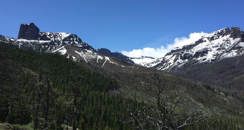
Absaroka Outdoor Fellowship hike. Photo by Leslie Tribble.

Blackwater Arch. Photo by Bernadette Butcher.

Absaroka Outdoor Fellowship hike. Photo by Leslie Tribble.
Location: Shoshone National Forest, In Shoshone National Forest S of US 14/16, 38 mi. W of Cody at Blackwater Lodge.
- States: Wyoming
The Blackwater NRT is a unique natural and historic experience that begins near and then accesses the site of the Blackwater wildfire fatality site. The Blackwater fire occurred in 1937 and was the site of a wildfire entrapment that trapped 48 men and killed 15 brave firefighters from the Forest Service and Civilian Conservation Corp (CCC) and Wyoming Bureau of Public Roads.
The trail begins near the Blackwater recreation resort and roadside Firefighter Memorial structure on the North Fork of the Shoshone River. The trail then follows a creek-side location to the site of the fatalities. A unique bronze and rock Memorial depicting the location of the fatalities is the most common destination. The history of the Memorial structures is almost as interesting as the event they memorialize. Designed for Forest Service employees and built by CCC enrollees in tribute to their fallen comrades, the structures are fine examples of stone masonry and design of the CCC era.
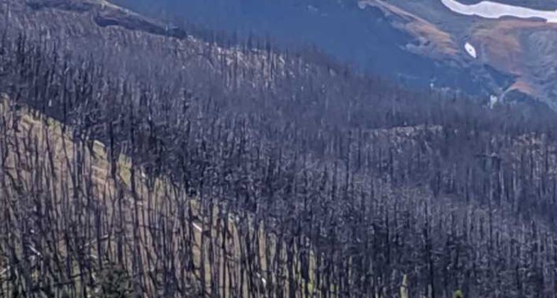
The upper Memorial is centered on a huge bronze diorama of the terrain and fire tragedy. The five-foot-in-diameter, stone and bronze plaque was packed by livestock to the site - no small feat in itself. The trail continues on to a smaller stone location, marking where some men survived the fire, and continues on a steep climb to Clayton Mountain, the site of a Forest Service lookout tower that no longer exists. The vistas from Clayton Mountain are well worth the energy required to climb the last mile of the trail. The vista reveals the huge expanse of the Washakie and North Absaroka Wilderness areas which together total more than a million acres of some of the wildest, untamed country left in the lower 48 states. Fauna that can be encountered along the trail includes mule deer, big horn sheep, elk, a number of bird species, and last, but not least, grizzly bears which are commonly seen in the area.
Accessibility Information
No text provided.
Reviews
Dannie OBrien
Trail Markers
This trail is poorly marked.Keep a topo map handy to cross reference your location with terrain features or you could end up at the Blackwater Arch or tepee by mistake. Remember there may be horses in the trail as you zoom downhill through the switchbacks.
Allowed Uses:
Bicycling Dogs, on leash Equestrian Motorized vehicles, snowmobilingOther Activities
- Camping
- Fishing
- Snow, snow play general
Public Contact
Trampus BarhaugShoshone National Forest
Waipiti Ranger District
Cody, WY 82414
(307) 527-6921
www.fs.fed.us/r2/shoshone
Contact the trail manager for current maps and visiting details.
More Details
- Elevation (low): 6450
- Elevation (high): 10219
- Elevation (cumulative): --
- Part of a Trail System? No
- National Designations: National Millenium
- Surface (primary): Soil
- Surfaces (additional): Soil
- Tread Width (average): 24"
- Tread Width (minimum): --
- Running length (minimum): --
- Tread Grade (average, percent): 10
- Tread Grade (maximum): 20
- Running length (maximum): --
- Cross-slope (average, percent): --
- Cross-slope (maximum): --
- Running length (maximum): --
- Certified as an NRT
Dec 12, 1979