Black Canyon Water Trail
check with the trail manager for updated details before visiting.
Black Canyon Water Trail
Other Federal
National Water Trail
- Length
30 miles
- Elevation Gain
--
- Route Type
out & back
(1 review)
- Length
30 miles - Elevation Gain
-- - Route Type
out & back
The Black Canyon Water Trail is located along a rugged and remote portion of the Colorado River of Arizona and Nevada. The trail follows the Colorado River through Black Canyon for approximately 30 miles, terminating at the historic mining area known as Eldorado Canyon on Lake Mohave.
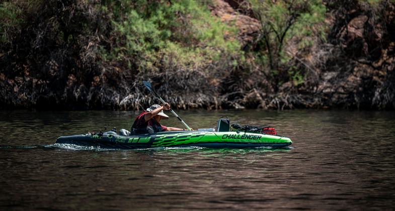
2025 Photo Contest Winner - Paddling and Water Trails Category. Photo by Robert Logan

USGS gauging station was built in the 1930s to measure the Colorado River just downstream from the newly rising Hoover Dam.


Location: The trail is located on the Colorado River beginning at the Hoover Dam Security Zone and extending south for approximately 30 miles to Eldorado Canyon, within Lake Mead National Recreation Area.
- States: Arizona, Nevada
- Counties: Clark, Mohave
- Cities/Townships: Boulder City and Nelson, Nevada are the communities located near the trail
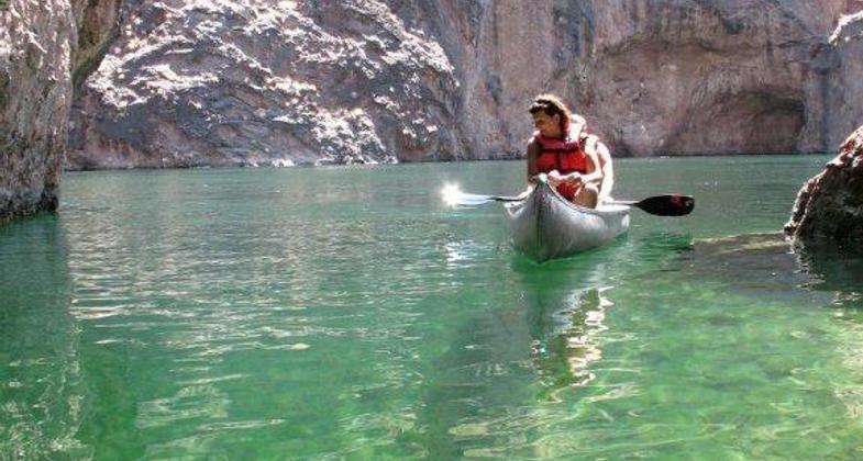
The Black Canyon Water Trail is located within Lake Mead National Recreation Area, a unit of the National Park System. The trip begins, as the river flows, at the base of Hoover Dam, one of the engineering marvels of the world, and meanders through 30 miles of the Colorado River where it enters Lake Mohave. This spectacular river setting provides unique paddling and rafting opportunities that are not matched in the southwestern United States. There are flowing hot springs in some of the side canyons and a great deal of history associated with the construction of and research connected to Hoover Dam including a sauna cave, gauging stations, catwalks, trails, and foundations of early inhabitants.
Approximately 12 miles downstream from Hoover Dam, you arrive at Willow Beach, a developed area that is the only road-accessible portion of the 30-mile stretch of river. Willow Beach is a historic river access site and is developed with all the amenities one would associate with a National Park Service development site. Rental crafts are available at Willow Beach for those who would like to access the river from this location.
The river, in the next segment, transitions into a lake but maintains the canyon environment with small bays and beaches appearing as you continue downstream. The setting is extreme and remote with designated wilderness on the Nevada side of the river and proposed wilderness on the Arizona side. As you approach Eldorado Canyon, the main canyon opens so that the size of Lake Mohave begins to be realized. The Eldorado Canyon is known for its mineral history. In the late 1800s and early 1900s, gold and silver mines were active in the mountains that form the horizon of Nevada. Steamboats would transport the ore from Eldorado Canyon down to the Gulf of California and onto mills in southern California.
Accessibility Information
No text provided.
Reviews
Jayna H
Awesome!
We hired an outfitter to rent our kayaks, get our permit and they dropped us off and picked us back up 3 days later. Launched at Hoover Dam (OMG, WOW) and camped/kayaked to Willow Beach. Amazing camping (wild skunks), kayaking and a ton of hot springs every quarter mile in the slot canyons. AMAZING experience!
Allowed Uses:
Boating, motorized Boating, human-powered SwimmingOther Activities
- Camping
- Fishing
- Heritage and history
- Wildlife viewing / observation
Public Contact
Robert SkordasBureau of Reclamation
Lower Colorado Dams Office
Boulder City, NV 89006
[email protected] • (702) 494-2301
More Details
- Elevation (low): --
- Elevation (high): --
- Elevation (cumulative): --
- Part of a Trail System? No
- National Designations: Hoover Dam and Lake Mead National Recreation Area
- State Designations: Nominating U.S. Highway 93 as Scenic Byway
- Surface (primary): --
- Surfaces (additional): Rock, boulders, Rock, smooth, Water, calm
- Tread Width (average): 0"
- Tread Width (minimum): 0
- Running length (minimum): --
- Tread Grade (average, percent): --
- Tread Grade (maximum):
- Running length (maximum): --
- Cross-slope (average, percent): 0
- Cross-slope (maximum): --
- Running length (maximum): --
- Certified as an NRT
Jun 5, 2014