Big Hole Battlefield
check with the trail manager for updated details before visiting.
Big Hole Battlefield
USDA Forest Service
Backcountry Trail
- Length
24 miles
- Elevation Gain
--
- Route Type
out & back
- Length
24 miles - Elevation Gain
-- - Route Type
out & back
Big Hole National Battlefield is located at 6,300 feet in the Rocky Mountains of Southwest Montana. In winter the park's trails are open for cross-country skiers and shoeshoeing.

The Nez Perce Camp Trail with the Sapphire Mountains in the distance. Photo by David Lingle.

Tipi poles mark the camps of the Nez Perce during the siege. The Park Headquarters are seen on the left. Photo by David Lingle.

The hike up to the Howitzer Site is challenging, but the views of the Big Hole Valley are worth the effort. Photo by David Lingle.
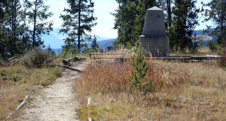
A monument to the Army fallen sits along the Siege Trail. Photo by David Lingle.

Logs line the trail as it passes through the Siege area. Photo by David Lingle.

The Siege Trail loops around depressions in the ground used by U.S. soldiers for cover. Photo by David Lingle.

The trail to the Howitzer Capture Site leaves the Siege Trail and climbs to the left. Photo by David Lingle.

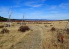
View of the Big Hole Valley from the Siege Trail. Hirschy Mountains is prominent on the left. Photo by David Lingle.

Siege Area Trails distances. Photo by David Lingle.

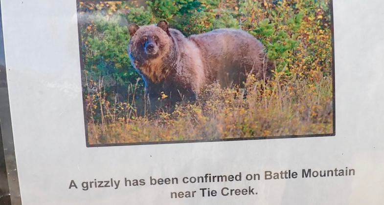
The Battlefield trails were closed briefly in 2019 due to Grizzly activity in the area. Photo by David Lingle.
Location: At Big Hole National Battlefield, ten miles west of Wisdom, MT on SH 43, In Gallatin National Forest, N of Earthquake Lake on SR 287.
- States: Montana
- Counties: Beaverhead
The Big Hole Battlefield Trail begins in the Sula Basin of the Bitterroot Range, crosses the Continental Divide, then follows Trail'Creek for about sixteen miles to the western park boundary of Big Hole National Battlefield.
The 221/2 miles of proposed trail follows the route of the Nez Perce Flight in 1877 from the Sula Basin to the Big Hole Battlefield. This same route was also used by Colonel John Gibbon's Seventh Infantrymen as they hurried to their encounter with the Nez Perce at the Big Hole in 1877, by General Howard's military command as they too followed the fleeing Nez Perce, and at various other times by settlers and miners as they passed from the mining communities of Montana and Idaho over the mountains to the Bitterroot Valley.
Accessibility Information
No text provided.
Allowed Uses:
Bicycling Equestrian Hiking/Walking Snow, cross-country skiing Snow, snowshoeingOther Activities
- Fishing
- Snow, snow play general
Public Contact
Big Hole National BattlefieldP.O. Box 237
Wisdom, MT 59761
Contact the trail manager for current maps and visiting details.
More Details
- Elevation (low): 6300
- Elevation (high): 6300
- Elevation (cumulative): --
- Part of a Trail System? No
- Surface (primary): --
- Surfaces (additional): --
- Tread Width (average): 0"
- Tread Width (minimum): --
- Running length (minimum): --
- Tread Grade (average, percent): --
- Tread Grade (maximum):
- Running length (maximum): --
- Cross-slope (average, percent): --
- Cross-slope (maximum): --
- Running length (maximum): --
- Certified as an NRT
Aug 7, 1977