Bearskin State Park Trail
check with the trail manager for updated details before visiting.
Bearskin State Park Trail
State
Rail Trail
- Length
18 miles
- Elevation Gain
--
- Route Type
out & back
(1 review)
- Length
18 miles - Elevation Gain
-- - Route Type
out & back
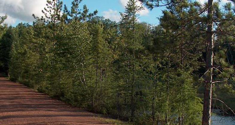
Former railroad runs through typical northern forest with a number of water crossings and access to wetland communities
Location: Rural, Minoequa.
- States: Wisconsin
Named for the Bearskin Creek the trail follows, this former railroad corridor is an opportunity to experience the Northwoods of Wisconsin. The railroad line was built to export white pine logs from the forests of northern Wisconsin to the cities of the Midwest. Today the trail is a recreation corridor, surfaced with compacted granite suitable for walking and bicycling in summer and snowmobiling in winter.
Few places in the world have more lakes per square mile than Oneida and Vilas counties. The lakes were formed by glaciers that melted and retreated north during the last Ice Age. Thirteen trestles cross the lakes and streams along the trail. The lakes of the Minocqua area are well known for their fishing.
The Northern Highland American Legion State Forest is nearby and offers a wide variety of recreation opportunities, including camping, hiking, bicycling, snowmobiling, canoeing, bird-watching, fishing, and hunting. The six-mile Hiawatha Trail in Lincoln County is also nearby. The Hiawatha Trail, on another segment of the same rail bed as the Bearskin State Trail, travels south from Heafford Junction to Tomahawk.
Accessibility Information
No text provided.
Reviews
Great biking!
I spent a lot of time on this trail over the years. Wonderful mountain biking through some of the best northwoods in WI.
Allowed Uses:
Bicycling Dogs, on leash Hiking/Walking Motorized vehicles, snowmobilingOther Activities
- Snow, snow play general
- Wildlife viewing / observation
Public Contact
John BrandenburgWisconsin Dept. of Natural Resources
4125 Hwy. M
Boulder Junction, WI 54512
(715) 385-2727
Contact the trail manager for current maps and visiting details.
More Details
- Elevation (low): --
- Elevation (high): --
- Elevation (cumulative): --
- Part of a Trail System? No
- Surface (primary): --
- Surfaces (additional): --
- Tread Width (average): 120"
- Tread Width (minimum): --
- Running length (minimum): --
- Tread Grade (average, percent): --
- Tread Grade (maximum):
- Running length (maximum): --
- Cross-slope (average, percent): --
- Cross-slope (maximum): --
- Running length (maximum): --
- Certified as an NRT
Aug 8, 1978