Bear Trap Trail
This information is a public record of the 1992 NRT application and may be out of date if it has not been updated by a trail manager --
check with the trail manager for updated details before visiting.
check with the trail manager for updated details before visiting.
Bear Trap Trail
Bureau of Land Management
Backcountry Trail
- Length
9 miles
- Elevation Gain
--
- Route Type
out & back
- Length
9 miles - Elevation Gain
-- - Route Type
out & back
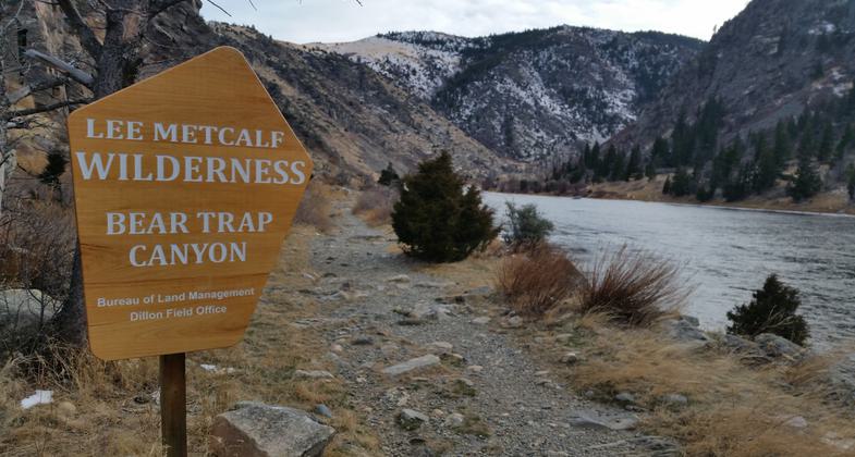
Beautiful winter day!. Photo by Jason ogle.

Overlooking Whitehorse Rapid

The trail follows the river for the length of the canyon. Photo by BLM.
Location: At Madison Dam below Ennis Lake off US 287 S of Three Forks.
- States: Montana
- Counties: Madison
Hiking trails follows the river the length of the canyon but cannot be accessed from the south end. The trail provides visitors outstanding hiking and backpacking. The trail drops down to meet the river periodically throughout its length, offering opportunities to filter water.
Accessibility Information
No text provided.
Allowed Uses:
Hiking/WalkingOther Activities
- Wildlife viewing / observation
Public Contact
Dillon Resource Area, BLM1005 Selway Dr.
Dillon, MT 59725
Contact the trail manager for current maps and visiting details.
More Details
- Elevation (low): --
- Elevation (high): --
- Elevation (cumulative): --
- Part of a Trail System? No
- Surface (primary): Soil
- Surfaces (additional): Soil
- Tread Width (average): 14"
- Tread Width (minimum): --
- Running length (minimum): --
- Tread Grade (average, percent): --
- Tread Grade (maximum):
- Running length (maximum): --
- Cross-slope (average, percent): --
- Cross-slope (maximum): --
- Running length (maximum): --
- Certified as an NRT
Sep 17, 1992