Bear Creek Trail
check with the trail manager for updated details before visiting.
Bear Creek Trail
USDA Forest Service
Backcountry Trail
Frontcountry Trail
- Length
19 miles
- Elevation Gain
--
- Route Type
out & back
- Length
19 miles - Elevation Gain
-- - Route Type
out & back
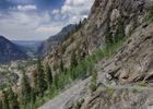
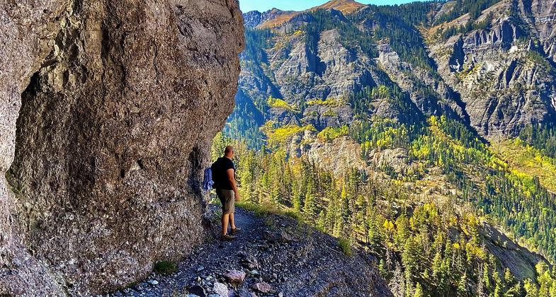
This exciting climb first goes up a series of switchbacks hewn out of the cliff face, then along ledges high above Bear Creek.

Photo by snowpeak on Flickr.
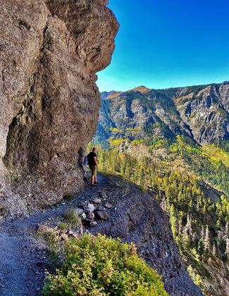
An NRT trail ambassador on the trail. Photo by Darla Klausner.
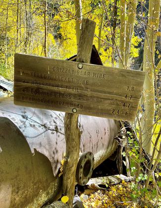
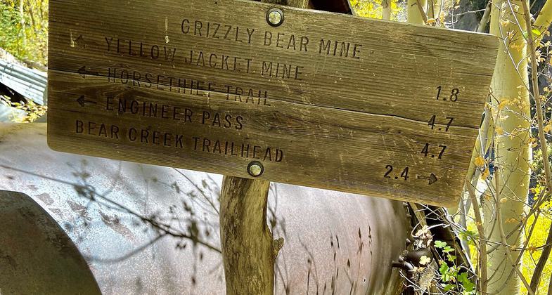
Grizzly Bear Mine sign. Photo by Darla Klausner.
Location: SW of Ouray, Colorado.
- States: Colorado
- Counties: Ouray
This exciting climb first goes up a series of switchbacks hewn out of the cliff face, then along ledges high above Bear Creek. As you get higher, more peaks are revealed, and also the valley northward, with the profile of Grand Mesa 70 miles away. A round trip, to either the Horsethief Trail or to Engineer Pass via the South Fork, is 14.1 miles with an altitude gain of 4,230 and 4,400 feet respectively.
The first switchbacks cross slides of slate and quartzite. Along the canyon trail watch for ripple marks from an ancient ocean preserved in rock on the canyon's opposite wall. Volcanic intrusions, called dikes, may be seen in many places along the trail. Switchbacks on the first part of the trail rise steadily for a gain of 1,000 feet, then the trail levels out for some stretches as it turns eastward along the Bear Creek gorge. The Grizzly Bear mine is reached after 2.4 miles. The Yellow Jacket mine is reached after a total of 4.2 miles.
If you are going on toward the Horsethief Trail, you have a choice of routes here, (shown on the Hiking Trails of Ouray County map). The most traveled route goes straight ahead and crosses the creek (look left for nice cascades). The old route starts with switchbacks by the mining machinery; care is needed in route-finding, but two creek crossings are avoided.
Accessibility Information
No text provided.
Allowed Uses:
Bicycling Dogs, on leash Hiking/WalkingOther Activities
- Wildlife viewing / observation
Public Contact
Angela AbelOuray Ranger District
2505 S. Townsend Ave
CO 81401
(970) 240-5425
www.fs.usda.gov/gmug
Contact the trail manager for current maps and visiting details.
More Details
- Elevation (low): --
- Elevation (high): --
- Elevation (cumulative): --
- Part of a Trail System? No
- Surface (primary): Paved
- Surfaces (additional): Paved
- Tread Width (average): 96"
- Tread Width (minimum): --
- Running length (minimum): --
- Tread Grade (average, percent): --
- Tread Grade (maximum):
- Running length (maximum): --
- Cross-slope (average, percent): --
- Cross-slope (maximum): --
- Running length (maximum): --
- Certified as an NRT
Nov 15, 1979