Bay de Noc - Grand Island Trail
check with the trail manager for updated details before visiting.
Bay de Noc - Grand Island Trail
USDA Forest Service
Backcountry Trail
- Length
42 miles
- Elevation Gain
--
- Route Type
out & back
- Length
42 miles - Elevation Gain
-- - Route Type
out & back
Location: Rapid River, Central Upper Peninsula of Michigan.
- States: Michigan
- Counties: Delta, Alger
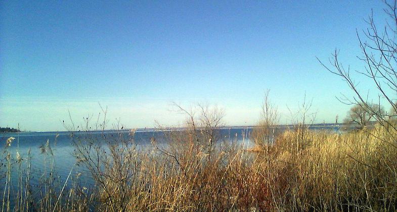
The trail takes a pleasant route over mostly flat to rolling forest land. On the south end, hikers will find plantations of red and jack pine; as they travel north, the forest turns to aspen and northern hardwoods, which are spectacular in the fall. Much of the trail follows the edge of the Whitefish River valley, and hikers are rewarded with intermittent views of the valley and river below. The Bay de Noc - Grand Island Trail is attractive to horseback riding and backpackers alike. Along its path are three trailheads whose facilities include camping, drinking water, and ample parking for horse trailers.
Accessibility Information
No text provided.
Allowed Uses:
Bicycling Dogs, on leash Equestrian Snow, cross-country skiingOther Activities
- Camping
- Snow, snow play general
Public Contact
Hiawatha National ForestRapid River Ranger District
Rapid River, MI 49878
[email protected] • (906) 474-6442
Contact the trail manager for current maps and visiting details.
More Details
- Elevation (low): 660
- Elevation (high): 960
- Elevation (cumulative): --
- Part of a Trail System? No
- Surface (primary): Sand
- Surfaces (additional): Sand
- Tread Width (average): 24"
- Tread Width (minimum): --
- Running length (minimum): --
- Tread Grade (average, percent): 2
- Tread Grade (maximum): 20
- Running length (maximum): --
- Cross-slope (average, percent): --
- Cross-slope (maximum): --
- Running length (maximum): --
- Certified as an NRT
May 5, 1980