Basin Lake Trail
check with the trail manager for updated details before visiting.
Basin Lake Trail
USDA Forest Service
Backcountry Trail
- Length
4.8 miles
- Elevation Gain
--
- Route Type
out & back
(1 review)
- Length
4.8 miles - Elevation Gain
-- - Route Type
out & back
The Basin Lakes Trail follows routes used for horse logging in the early 1900s, and serves as access to upper and lower basin lakes.
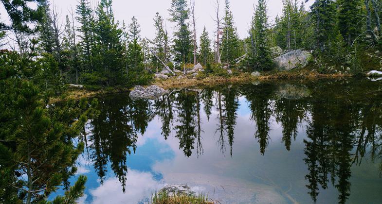
Photo by Kasie Haack.

On the Trail. Photo by Kasie Haack.

Basin Creek. Photo by Kasie Haack.

View from the trail. Photo by Kasie Haack.

Lower Basin Lake. Photo by Kasie Haack.

Upper Basin Lake. Photo by Kasie Haack.

Basin Lake. Photo by USFS.
Location: 8 miles west of Red Lodge, MT., In Custer National Forest, 8 mi. W of Red Lodge on West Fork Rock Creek Road.
- States: Montana
- Counties: Carbon
Basin Lakes National Recreation Trail #61 is four miles long. The trail is a steady forested climb to upper and lower Basin Lakes passing a waterfall along the way. Lower Basin Lake is partially covered with lily pads and Upper Basin Lake offers scenic views of the surrounding mountains.
Accessibility Information
No text provided.
Reviews
Kasie Haack
Great Views
Arrived around 11 am to a packed parking lot. Popular trail especially on a Saturday. Less than a quarter mile in is a downed tree suspended across the trail. The trail is pretty steep all the way up, but completely worth it. The creek crossing about 3/4 th of a mile in was at least a foot deep. From the Lower to the Upper Basin Lake the trail is covered in snow and mud for a good majority of it, but passable. Hiked the entire thing in my trusty sandals and had a blast.
Allowed Uses:
Dogs, on leash Hiking/Walking Snow, cross-country skiing Snow, snowshoeingOther Activities
- Camping
- Fishing
- Snow, snow play general
- Wildlife viewing / observation
Public Contact
Allie WoodBeartooth Ranger District
HC 49 Box 3420
Red Lodge, MT 59068
(406) 446-2130
www.+fs.fed.us/r1/custer
Contact the trail manager for current maps and visiting details.
More Details
- Elevation (low): 6902
- Elevation (high): 9000
- Elevation (cumulative): --
- Part of a Trail System? No
- Surface (primary): Soil
- Surfaces (additional): Soil
- Tread Width (average): 18"
- Tread Width (minimum): --
- Running length (minimum): --
- Tread Grade (average, percent): 5
- Tread Grade (maximum): 5
- Running length (maximum): --
- Cross-slope (average, percent): --
- Cross-slope (maximum): --
- Running length (maximum): --
- Certified as an NRT
Nov 26, 1979