Bartram Trail (AL)
check with the trail manager for updated details before visiting.
Bartram Trail (AL)
USDA Forest Service
Backcountry Trail
- Length
8.5 miles
- Elevation Gain
--
- Route Type
out & back
- Length
8.5 miles - Elevation Gain
-- - Route Type
out & back
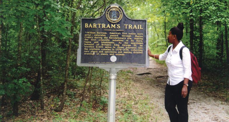
The Bartram Trail passes through various types of forest wildlife habitat. Trail hikers can see a wide variety of wildflowers and flowering trees, including dogwood and magnolias.

Location: Spans the length of Tuskegee NF, NE of Tuskegee, N of US 80.
- States: Alabama
The scenic Bartram Trail is the first trail in Alabama to be designated a National Recreation Trail. The trail runs through the Tuskegee National Forest. The Bartram Trail passes through various types of forest wildlife habitats. Trail hikers can see a wide variety of wildflowers and flowering trees, including dogwood and magnolias. Bartram Trail hikers may also get a fleeting glimpse of deer, turkey, or other wildlife as they scurry through the forest.
Accessibility Information
No text provided.
Allowed Uses:
Hiking/WalkingPublic Contact
Tuskegee Ranger District2946 Chestnut St.
Montgomery, AL 36107
(334) 727-2652
Contact the trail manager for current maps and visiting details.
More Details
- Elevation (low): --
- Elevation (high): --
- Elevation (cumulative): --
- Part of a Trail System? No
- Surface (primary): Soil
- Surfaces (additional): Soil
- Tread Width (average): 36"
- Tread Width (minimum): --
- Running length (minimum): --
- Tread Grade (average, percent): 3
- Tread Grade (maximum):
- Running length (maximum): --
- Cross-slope (average, percent): --
- Cross-slope (maximum): --
- Running length (maximum): --
- Certified as an NRT
May 31, 1976