Barclay Farm Trails
check with the trail manager for updated details before visiting.
Barclay Farm Trails
City, Town, or County
Backcountry Trail
- Length
1 mile
- Elevation Gain
--
- Route Type
Loop
(1 review)
- Length
1 mile - Elevation Gain
-- - Route Type
Loop
The network of four trails totaling one mile, through vegetative types including wetlands, pond and mature forest is anchored at an eighteenth century farmhouse, the final stop on the Cooper River Historic Trail.
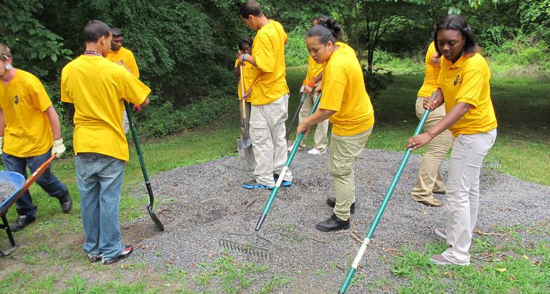
Photo by Lew Gorman III.
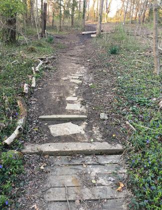
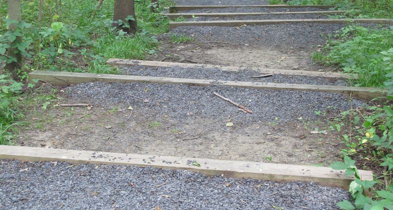
Mormon Missionary Volunteers build raised footpath on the Barclay Farmstead Nature Trail, Cherry Hill, NJ
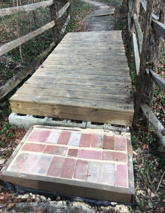
Photo by Lewis Gorman III.
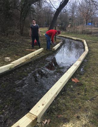
Photo by Lewis Gorman III.
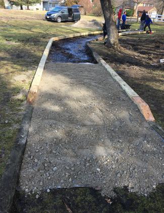
Photo by Lewis Gorman III.
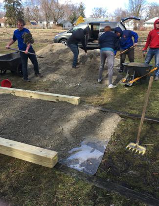
Photo by Lewis Gorman III.
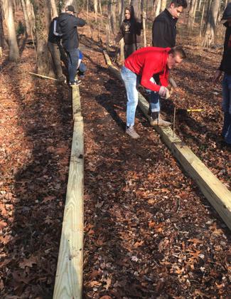
Photo by Lewis Gorman III.
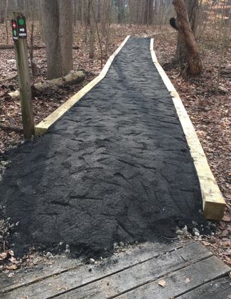
Photo by Lewis Gorman III.
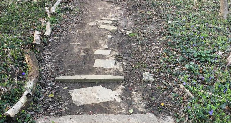
Before trail improvements. Photo by Lewis Gorman III.
Erosion prevention. Photo by Lewis Gorman III.


Location: Barclay Farmstead, Cherry Hill, NJ
- States: New Jersey
- Counties: Camden
- Cities/Townships: Cherry Hill Township
Barclay Farm Trails is an interconnected system of trails totaling three-quarters of a mile located on a National Register of Historic Places designated eighteenth-century farmstead that is now Cherry Hill Township Open Space land. Cherry Hill, NJ is a Philadelphia suburban community of about 75,000 residents on. More than 95 percent of the Township's land is developed; making trails through open space lands a rare and important link to nature for area residents.
The network of four trails winds through different natural habitats including wetlands, riparian, ponds, and mature forests. Wetland and riparian habitats are important habitat types in short supply in the state of New Jersey as highlighted by the state's Wildlife Action Plan. The New Jersey Audubon selected the Barclay Farm area as one of the stops on their state-wide Birding and Wildlife Viewing Trails. Signs indicating this recognition are posted at Barclay Farm trailheads. Further, the Barclay property is the terminus of the 15-stop Cooper River Historic Trail. This trail highlights historic properties along Cooper River. Starting at the Cooper Mansion in Camden it ends 12 miles later at Barclay Farmstead.
Barclay Farmstead Trail signs start at the street entrance to the property. An arrow on the sign points toward the parking lot where a second directional arrowed sign points to the trailhead. The network of three trails includes an accessible trail, a hiking trail, and a nature trail. The handicapped trail features a stone-surfaced 0.16-mile trail that largely overlaps the beginning of the nature trail.
The hiking trail begins at one end of the accessible trail in a mature forest, passes through a forest, and follows the North Branch of the Cooper River until it links with the nature trail midway along its length.
Of the three trails, one is designated as the Barclay Farm Nature Trail. Snaking through the mature forest past a pond, wetland, and the North Branch of the Cooper River, it features ten stops marked by wooden posts and brown aluminum signs showing a nature sticker and numbers one through 10. The signs are attached with quarter-inch bolts and countersunk to help avoid vandalism. The trailhead sign, 12" X 18", has the same brown background with the trail's name and a line to create separate spaces for appropriate stickers. The trailhead sign pattern is the same for the nature trail and the other trails in the Cherry Hill Trail system.
The nature trail guide interactively discusses soil, vegetation, trees, wildlife, wetlands, birds, decomposition, habitat, and biodiversity in a question-and-answer format. The answers are provided to promote use by families to better connect with nature. The last nature trail pamphlet entry challenges trail users to help improve the environment. The trail guide boxes are installed at each end of the trail so trail users can use the environmental education tool regardless of which end of the trail they enter first. The trail guide is attached to this application. A highlighted section on the trail guide's last page asks nature trail guide users to deposit the guide in the box at the end of the trail so others can reuse it. This was designed to extend the life of the trail guides and reduce the need to restock nature trail guides.
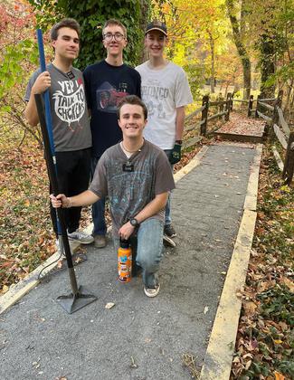
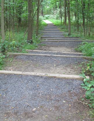
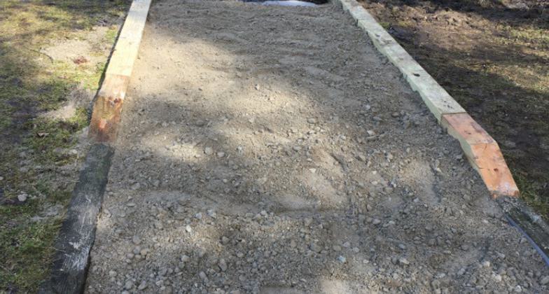
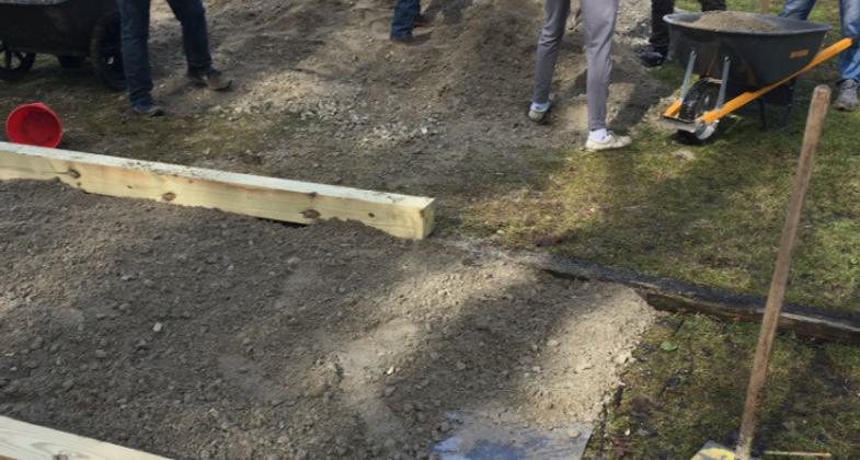
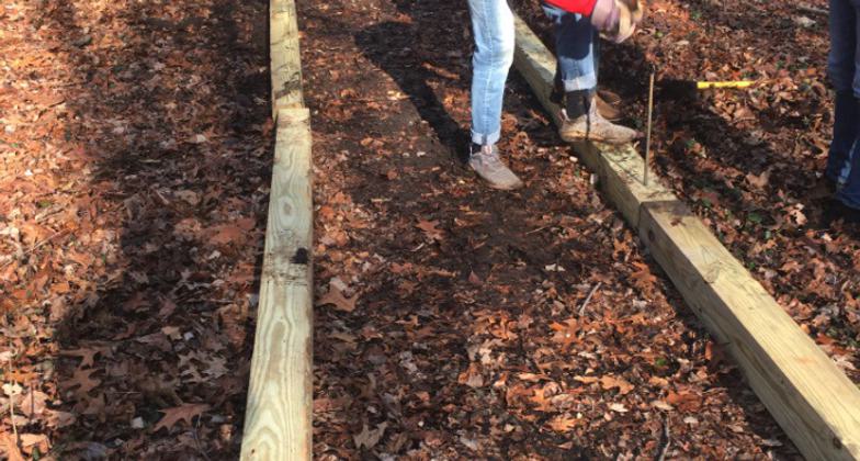
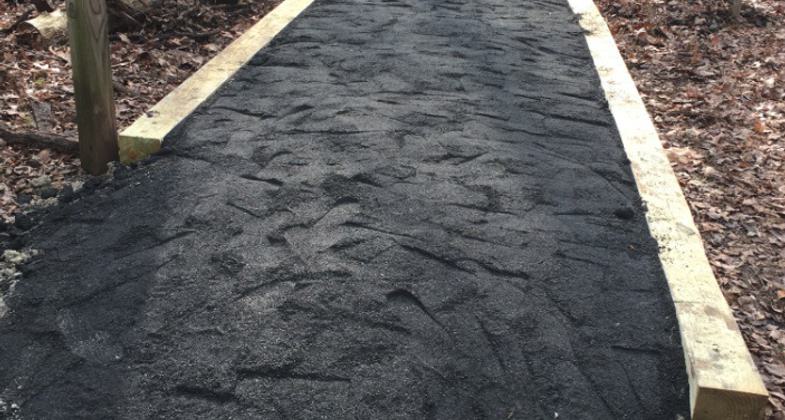
Barclay Farm Trails provides the opportunity for community public service. Three Boy Scouts completed their Eagle Scout Project while improving the trails at this location. One project improved the surface and construction of the handicapped trail and updated the main trail map board located at the Barclay Farm Trailhead. Two other projects installed raised walkways in the riparian habitat portion of the Barclay Nature Trail to promote nature trail use during wet periods.
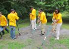
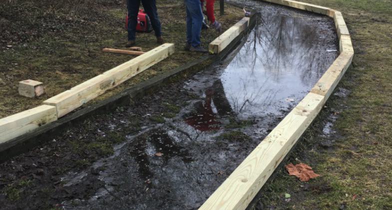
Cherry Hill Township's Cherry Hill Environmental Advisory Committee coordinates the township's activities for National Public Lands Day (NPLD). Barclay Farm Trails was the location for this public service event in 2007 and 2008. Trail surface improvements were made each time. In 2007 wood chips were added to the surface of the handicapped trail. Since their decay necessitated regular reapplication, it was decided to surface the accessible trail with stone. This was a key feature of Cherry Hill's 2008 NPLD event at Barclay. CHEB installed erosion control devices on one section of the nature trail to stabilize the trail surface and halt erosion into the riparian habitat.
Trail maintenance is performed by a mix of Cherry Hill DPW, CHEB, and others volunteers. DPW loans tools and delivers bulk materials like stone. CHEB performs and keeps track of trail maintenance needs, installs signage, and coordinates volunteer trail community service with the Cherry Hill Recreation Department. Improvements to trails occur regularly.
Barclay Trail promotion is accomplished with CHEB taking the lead in outreach product development. CHEB developed the Barclay Nature Trail Guide. CHEB prepared a document that illustrates the trail layout, description, location, and key features. After review and approval by the Recreation Department and Mayor's Office, it was posted on the Cherry Hill website by the Cherry Hill IT Department. CHEB promotes trails at community events including the Cherry Hill Fall Festival and the Cherry Hill Earth Day celebration at Croft Farm. Barclay Farm Trails and other Cherry Hill trails are promoted at these events to connect people with nature, increase support for Open Space lands, and highlight outdoor recreational opportunities in the community.
History of Barclay Farmstead
Built in 1816 by a Quaker farmer, Joseph Thorn, the farmhouse and surrounding the 32-acre property offer visitors an opportunity to observe and participate in the agrarian lifestyle that once dominated the South Jersey landscape. Now listed on the National & New Jersey Registers of Historic Places, the Barclay Farmstead is owned and operated by Cherry Hill Township. In 1826, Joseph W. Cooper, a sixth-generation descendant of the founder of Camden and the owner of Camden's Cooper Ferry, acquired the 168-acre property as a retreat to escape the city's hot summer days. Eventually, "Chestnut Grove Farm," as it came to be known, was passed along to Joseph Cooper's great-granddaughter, Helen Champion Barclay. Today visitors can step back to 1816 to tour the house as well as a reconstructed tool shed, a corn crib, a springhouse, a kitchen garden, an orchard, and community garden plots.
Accessibility Information
No text provided.
Reviews
Lewis Gorman III
Trail Improvements.
This month, November 2018, a kiosk was added to the trailhead as part of an Eagle Scout Project9 This is the third Eagle Scout project completed since the trail system was establish in approximately 2008.
Allowed Uses:
Bicycling Dogs, on leash Hiking/Walking Snow, cross-country skiing Snow, snowshoeingOther Activities
- Heritage and history
- Snow, snow play general
- Wildlife viewing / observation
Public Contact
Megan BrownCherry Hill Township
820 Mercer Street
Cherry Hill, NJ 08002
[email protected] • (856) 488-7868
www.cherryhill-nj.com
Contact the trail manager for current maps and visiting details.
More Details
- Elevation (low): --
- Elevation (high): --
- Elevation (cumulative): --
- Part of a Trail System? No
- Surface (primary): Soil
- Surfaces (additional): Boardwalk, Rock, crushed, Wood chips/mulch
- Tread Width (average): 48"
- Tread Width (minimum): --
- Running length (minimum): --
- Tread Grade (average, percent): 1
- Tread Grade (maximum): 3
- Running length (maximum): --
- Cross-slope (average, percent): --
- Cross-slope (maximum): --
- Running length (maximum): --
- Certified as an NRT
May 19, 2011