Balfour Riverwalk Trail
check with the trail manager for updated details before visiting.
Balfour Riverwalk Trail
City, Town, or County
Frontcountry Trail
Urban Trail
- Length
0.25 miles
- Elevation Gain
--
- Route Type
out & back
(2 reviews)
- Length
0.25 miles - Elevation Gain
-- - Route Type
out & back
This 0.25-mile urban trail and greenway is a key component of Attleboro's downtown redevelopment plans and supports the Young Men's Christian Association's Activate America program by providing recreational amenities for all ages to enjoy.
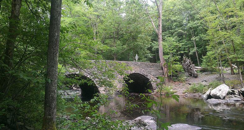
Bridge over the Ten Mile River. Photo by Charles Fulton wiki.
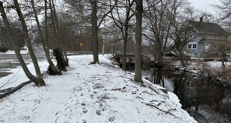
I think this is part of the trail... Photo by Janie Walker.
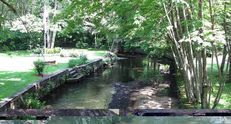
Ten Mile River, Attleborough Falls Massachusetts. Photo by John Phelan wiki.
Location: Bristol County, MA, Connects downtown Attleboro to Ten Mile River shoreline.
- States: Massachusetts
- Counties: Bristol
This 0.25-mile urban trail and greenway is a key component of Attleboro's downtown redevelopment plans and supports the Young Men's Christian Association's Activate America program by providing recreational amenities for all ages to enjoy.
Accessibility Information
No text provided.
Reviews
Brian Hatch
Riverwalk Arts coming to Balfour Park!
Soon, Balfour Park will be part of Attleboro's Riverwalk Arts program! It now connects to Robbins Park along the Kevin Dumas Boardwalk and a new Rainkeep rainharvesting sculpture will soon be a preeminent feature.
Janie
Needs signage and a map
I am pretty sure I got this trail since I began at Balfour Riverwalk Park, crossed the bridge, went down the stairs, and walked all the little dirt paths by the river I could find, past the community garden and all the way to the stone waterfall in the woods. However, it all seemed like little dirt paths alongside the road. There were no markers or indication that it was an actually trail except for a few signs that were illegible and looked like they were put up decades ago and never maintained. Not sure why this is a National Recreation Trail.
Allowed Uses:
Bicycling Hiking/WalkingPublic Contact
Aurelio AlmeidaCity of Attleboro, Dept. of Parks and Forestry
77 Park St., Government Center
Attleboro, MA 2703
[email protected] • (508) 226-6487
Contact the trail manager for current maps and visiting details.
More Details
- Elevation (low): --
- Elevation (high): --
- Elevation (cumulative): --
- Part of a Trail System? No
- Surface (primary): --
- Surfaces (additional): Paved
- Tread Width (average): 0"
- Tread Width (minimum): --
- Running length (minimum): --
- Tread Grade (average, percent): --
- Tread Grade (maximum):
- Running length (maximum): --
- Cross-slope (average, percent): --
- Cross-slope (maximum): --
- Running length (maximum): --
- Certified as an NRT
May 31, 2007