Autauga Creek Canoe Trail
check with the trail manager for updated details before visiting.
Autauga Creek Canoe Trail
Nonprofit
Water Trail (other)
- Length
13 miles
- Elevation Gain
--
- Route Type
out & back
(2 reviews)
- Length
13 miles - Elevation Gain
-- - Route Type
out & back
Historic waterway upon which the town of Prattville was built. Now a 13-mile canoe trail, with the most popular 3-hour paddle beginning right behind City Hall. Autauga Creek offers spring-fed and shaded Class 1 moving water for kayaking and canoeing, with segments also well suited for tubing and pedal boats.<br><br>
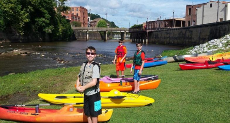
RiverKids at Creekwalk. Photo by Christy Sudduth
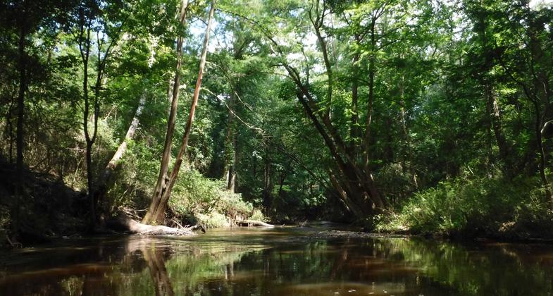
Autauga Creek. Photo by Sheila DeRamus Wood.

Location: Autauga County, Alabama blueway, passing south through the City of Prattville to the Alabama River.
- States: Alabama
- Counties: Autauga
- Cities/Townships: Prattville
Autauga Creek Canoe Trail begins at Bridge Creek access on CR 10 in Autauga County. Confluence with Autauga Creek is within a mile, then Prattville Paddlesports access point and ASRT primitive camping site in two miles. Creek mile and half-mile markers start with 0 at the Alabama River and through 12 above the dam.
The upper edge of Prattville's millpond begins between mile markers 7 and 6.5. This is a mild stretch of the creek on which any child between ages 8 and 17 can learn to kayak with ACIC's free 4-H RiverKids program, designed by the Alabama Scenic River Trail and piloted on Autauga Creek in 2014 when it introduced 146 kids to outdoor recreation in the form of kayaking. RiverKids access at Allenville Road offers trash cans and picnic tables. It is an ideal spot for an easy family outing on the water with no need to drive to a separate take-out site.
Upon reaching the dam overlooking downtown Prattville, paddlers will be directed to exit the pond river left and portage their vessels along a grassy path through Heritage Park leading to the Creekwalk re-entry point behind City Hall and the Creative Arts Center at 342 Chestnut Street. ASRT portage signs are expected to be installed for this portage route by 2015. Until then, paddlers are expected to exit above the Fourth Street bridge, where parking is provided at the site of a city park under construction on Allenville Road access.
Kayaks and canoes share the most popular stretch of Autauga Creek with families floating on tubes, swimming, wading, splashing, playing fetch with their four-legged companions, and even fly fishing below the dam. This is a gentle mile-long segment from MM 6 atop the dam to MM 5 at Doster Well Park. Tube floaters exit the creek at Legion Landing to walk back up the newly constructed Creekwalk expansion path through Pratt Park, which contains a playground, bathrooms, water fountain, and Splash Pad in addition to a popular creek swimming hole by MM 5.5.
At MM 5, canoes and kayaks put their maneuverability to the test through a series of twists and turns past cypress knees and old downed trees. This is a Class I (not whitewater) blueway with surprisingly swift, narrow channels which are used by the Prattville Fire Department to host annual statewide swift water rescue training. Autauga Creek is a paddling gateway to develop skills on moving water which naturally leads to expanded recreational horizons for more new participants across the Alabama River Region.
Autauga Creek Canoe Trail's most technically challenging 1.5-mile segment between MM 5 at Doster Well Park and MM 3.5 also features a primitive ASRT campsite accessible only from the creek, across from an impressive stand of giant bamboo. (Prattville also contains a bamboo park called "Wilderness Park," which was used to train soldiers for conditions in Vietnam.)
After meandering beneath Hwy 82, a commercial RV campground also allows tent camping for a fee near MM 2.5. Near the entrance of this campground is another free public access point for a short float trip past the historic McNeill Mill site, where Daniel Pratt built cotton gins and ran a grist mill before moving operations farther upstream to found the town of Prattville. The McNeill Mill site is marked with a marker sign facing the canoe trail specifically to be seen by paddlers. The Autauga Creek Improvement Committee is still working with the family of land owner James W. Reynolds to unearth more of the history at this site, and the International Paper Foundation has provided a grant towards this effort. Titan Fabrication and the Autauga County Heritage Association have also partnered with ACIC to provide historic marker signs for this site, and have planned more marker signs for other historic locations along the canoe trail, including two textile mill sites.
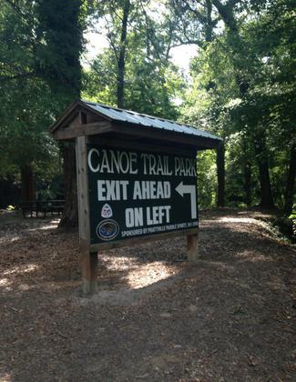
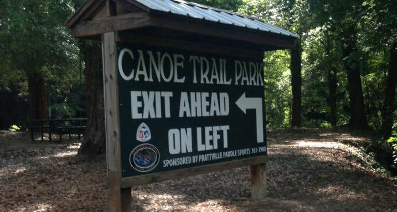
Most trail users choose to take out at MM 2, Canoe Trail Park. Others continue to the confluence with the Alabama River and beyond. It is possible to paddle back upstream and is easiest when water levels are up. Canoe Trail Park offers restrooms, running water, a grill, picnic tables, garbage cans, and parking. Two free primitive campsites are accessible to paddlers, and the creek is part of the Alabama Scenic River Trail network.
Accessibility Information
No text provided.
Reviews
Doug Darr
Unique
Autauga Creek is a Coast Plain stream with a sand and stable gravel bottom. Although it flows through the city, you will only see glimpses of civilization. The four mile trip to the Humane Shelter is by far most popular. It can be done in 1-1/2 hours, but 4 hours should be allowed. The float quality if very dependent upon flow. CHECK THE GAGE, available on-line.
Sheila DeRamus Wood
Autuaga Creek Paddling
It's a beautiful, well maintained creek! There are several launch area below the dam but most used is the one right behind Prattville's City Hall - you enter off Chestnut street between the back of City Hall and the Canoe Planter. This paddle is a 4 mile stretch of a twisting and turning waterway among cypress trees and cypress knees and some down trees that are all passable thanks to the Autauga Creek Improvement Committee and their wonderful chain saw crews. The Upper Creek above the dam, from Mile Marker 13 down to the dam at Mile Marker 6 is a work out in itself. There are many obstacles to maneuver around, over or under. Be prepared to portage over some down trees or beaver dams. Come, paddle with us and have a new paddling memory to add to you list! Sheila DeRamus Wood, Sec. ACIC
Allowed Uses:
Boating, human-powered Swimming Dogs, on leashOther Activities
- Camping
- Fishing
- Heritage and history
Public Contact
Iris KorthauerAutauga Creek Trails
444 Cargill Street
Prattville, AL 36067
[email protected] • (334) 361-9302
More Details
- Elevation (low): --
- Elevation (high): --
- Elevation (cumulative): --
- Part of a Trail System? No
- Surface (primary): Water, slow moving
- Surfaces (additional): Water, calm
- Tread Width (average): 0"
- Tread Width (minimum): 0
- Running length (minimum): --
- Tread Grade (average, percent): --
- Tread Grade (maximum):
- Running length (maximum): --
- Cross-slope (average, percent): 0
- Cross-slope (maximum): --
- Running length (maximum): --
- Certified as an NRT
Jun 3, 2015