Art Loeb Trail
check with the trail manager for updated details before visiting.
Art Loeb Trail
USDA Forest Service
Backcountry Trail
- Length
31 miles
- Elevation Gain
--
- Route Type
out & back
- Length
31 miles - Elevation Gain
-- - Route Type
out & back
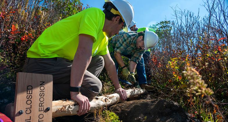
2025 Photo Contest Winner - Youth and Volunteers Category. Photo by Amber Gibbs


Art Loeb Trail. Photo by Jay Julian.

Location: Pisgah Ranger District, In the Pisgah National Forest, connects Davidson River trailhead across Blue Ridge Parkway to Shining Rock Wilderness.
- States: North Carolina
- Counties: Transylvania, Haywood
Section #1 - Difficult - After beginning near, then leaving, the Davidson River, Section 1 climbs steeply to Shut-in Ridge. Once there, don't expect the hard part to be over. The trail will take you up and down knobs, along ridges, and down into several gaps. Points of interest include ridge top views; Cedar Rock Mountain; and Butter Gap Shelter, where there is a spring very close by. [Note: On Section 1, in addition to white blazes, you may also see blue dots, which are leftovers from a trail designation no longer in use.]
Approximate Elevation Change: 1,300 feet
Blaze: White
Section #2 - 7.2 mi - Difficult - From Gloucester Gap, the trail climbs to Pilot Mountain, a former fire tower site with a 360-degree view. In mid-May, the north side of Pilot Mountain is abloom with Pinkshell Azalea. There is a shelter and a spring at Deep Gap. The trail then climbs to the Blue Ridge Parkway, winding through a mature, upland hardwood forest. From the parkway, it is a steep climb to Silvermine Bald, where there is a transition from a hardwood forest to a spruce-fir forest. Grass balds and an abundance of Catawba Rhododendron make this a good spot to take a hike in late June when these showy shrubs bloom. Near Silvermine Bald, the Mountains-to-Sea Trail joins from the west as the Art Loeb Trail follows the ridge northeast to FS 816. [Note: South of Silvermine Bald, in addition to white blazes, you may also see blue dots, which are leftovers from a trail designation no longer in use.]
Approximate Elevation Change: 2,600 feet
Blaze: White
Section #3 - 6.8 mi - Difficult - The first half of this portion of the Art Loeb Trail is perhaps the most spectacular. Black Balsam Knob and Tennent Mountain both exceed 6,000 feet in elevation. Grass balds provide outstanding views during clear weather, but at this high elevation you can expect cold, rainy weather much of the year. A beautiful five-mile loop may be made by combining the Art Loeb Trail with the Ivestor Gap Trail (#101). At Ivestor Gap the Art Loeb Trail enters the Shining Rock Wilderness while remaining on or near the ridgeline, so additional views are available as it goes in and out of trees. Be prepared to practice map reading and compass skills, since there are no blazes or signs in the wilderness area. Wood fires are not permitted in the Wilderness, and a group size limit of 10 is enforced. These measures are in place to enhance solitude and protect the primitive character that wilderness areas are set aside for. Please help foster this by staying as quiet as possible; taking rest breaks out of sight of the trail; and, whenever possible, using existing campsites that are out of sight of the trail. This section of the Art Loeb Trail traverses a narrow alpine-like ridge aptly named The Narrows before ending at Deep Gap, where Cold Mountain Trail (#141) can be accessed.
Approximate Elevation Change: 1,000 feet
Blaze: White
Section #4 - 3.8 mi - Difficult - This is a short, but very steep, section of the Art Loeb NRT that provides access to Cold Mountain via Cold Mountain Trail (#141). Since it is entirely within a Congressionally-designated wilderness, you will find no signs or trail blazes. Be prepared to practice map reading and compass skills. Wood fires are not permitted in the Wilderness, and a group size limit of 10 is enforced. These measures are in place to enhance solitude and protect the primitive character that wilderness areas are set aside for. Please do your part to enhance others' wilderness experience by staying as quiet as possible; taking rest breaks out of sight of the trail; and, whenever possible, using existing campsites also out of sight of the trail. We challenge you to minimize your impact on the land. When you leave, will others know that you have passed this way?
Approximate Elevation Change: 1,800 feet
Blaze: None
Accessibility Information
No text provided.
Allowed Uses:
Swimming Hiking/WalkingOther Activities
- Camping
Public Contact
Jeff OwenbyPisgah Ranger District
1001 Pisgah Highway
Pisgah Forest, NC 28802
[email protected] • (828) 877-3265
www.fs.usda.gov/nfsnc
Contact the trail manager for current maps and visiting details.
More Details
- Elevation (low): 2100
- Elevation (high): 6000
- Elevation (cumulative): --
- Part of a Trail System? No
- National Designations: National Millenium
- Surface (primary): Soil
- Surfaces (additional): Soil
- Tread Width (average): 18"
- Tread Width (minimum): --
- Running length (minimum): --
- Tread Grade (average, percent): 10
- Tread Grade (maximum): 25
- Running length (maximum): --
- Cross-slope (average, percent): --
- Cross-slope (maximum): --
- Running length (maximum): --
- Certified as an NRT
Oct 4, 1979