Arrowwood NWR Leg of the Historic Ft. Totten Trail
check with the trail manager for updated details before visiting.
Arrowwood NWR Leg of the Historic Ft. Totten Trail
U.S. Fish and Wildlife Service
Backcountry Trail
- Length
9.92 miles
- Elevation Gain
--
- Route Type
out & back
(1 review)
- Length
9.92 miles - Elevation Gain
-- - Route Type
out & back
Location: At Arrowwood NWR W of Kensal on SR 9.
- States: North Dakota
- Counties: Stutsman
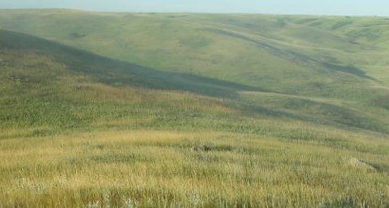
This development of this trail was to reestablish nine miles of the historic trail that connected the military posts of Ft. Seward near Jamestown, North Dakota, and Ft. Totten on the south shores of Devil's Lake. The Jamestown/Stutsman Development Corporation has successfully competed for a grant to purchase and install eight gates on the trail that can be opened and closed from horseback, and for a split-rail fence to be constructed at the south trailhead.
The U.S. Fish and Wildlife Service intends to develop the south trailhead to accommodate parked vehicles and horse trailers, and to develop interpretive kiosks and trail markers. Interpretive kiosks will educate the visiting public about conservation and the wildlife mission of the Service and will celebrate the American Indian tribes and culture that existed prior to European settlement. Development of the trail will better enable the Service to achieve its goal of providing quality wildlife-dependent recreational opportunities such as wildlife observation and wildlife photography.
The refuge has added a parking area with picnic tables, a vault toilet, parking for horse trailers with a hitching rail, and a boat dock for non-motorized boats.
Accessibility Information
No text provided.
Reviews
Wendy Schmeichel
Historic trail
Trail is long but can be broken into smaller sections. Doesnt have to be done all in 1 shot. First part you do get to see the river valley at times and it was beautiful with all the fall colors. It is part of an old military supply route so it is pretty flat and easy to hike. You actually hike on the road bed that is mowed grass.
Allowed Uses:
Dogs, on leash Hiking/WalkingPublic Contact
U.S. Fish & Wildlife Service, Arrowwood NWR7745 11th St. SE
Pingree, ND 58476
[email protected] • (701) 285-3341
www.fws.gov/arrowwood
Contact the trail manager for current maps and visiting details.
More Details
- Elevation (low): 1450
- Elevation (high): 1540
- Elevation (cumulative): --
- Part of a Trail System? No
- State Designations: <quote>Limpy Jack<apos>s Leg of the Arrowwood NWR
- Surface (primary): Rock, crushed
- Surfaces (additional): Rock, crushed
- Tread Width (average): 120"
- Tread Width (minimum): --
- Running length (minimum): --
- Tread Grade (average, percent): 1
- Tread Grade (maximum): 9
- Running length (maximum): --
- Cross-slope (average, percent): --
- Cross-slope (maximum): --
- Running length (maximum): --
- Certified as an NRT
May 31, 2008