Arkaquah
check with the trail manager for updated details before visiting.
Arkaquah
USDA Forest Service
Backcountry Trail
- Length
5.5 miles
- Elevation Gain
--
- Route Type
out & back
(1 review)
- Length
5.5 miles - Elevation Gain
-- - Route Type
out & back
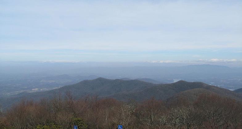
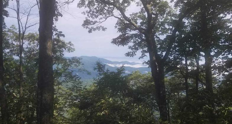
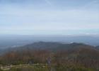
View from Brasstown Bald. Photo by wiki.
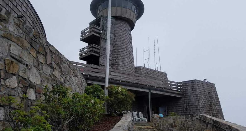
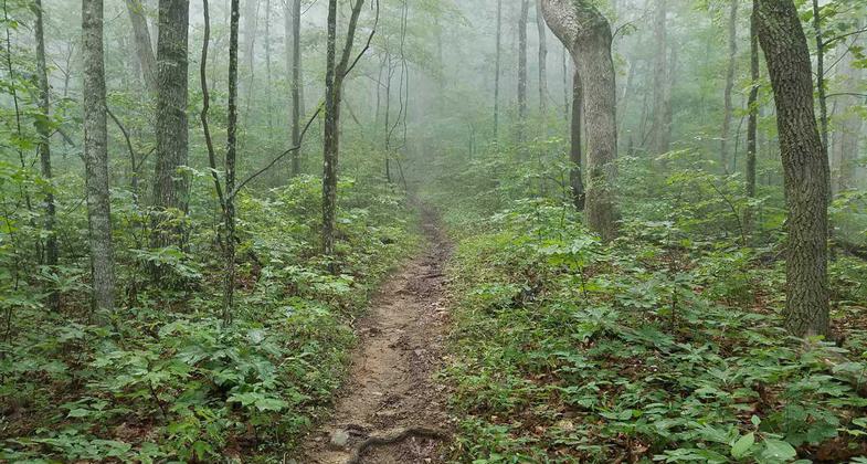
July 2017 hike to the highest point in Georgia (USA), Brasstown Bald Mountain. Photo by Kelly Carter.
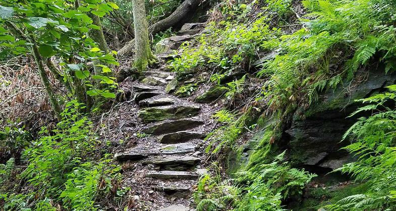
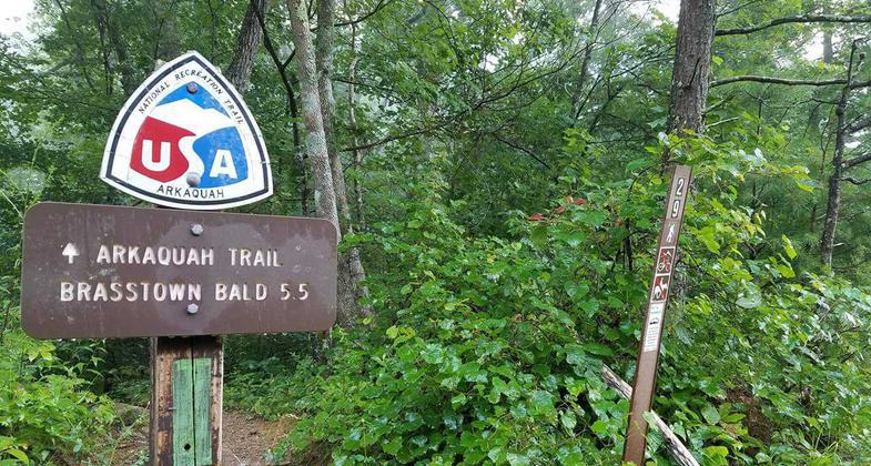
July 2017 hike to the highest point in Georgia (USA), Brasstown Bald Mountain. Photo by Kelly Carter.
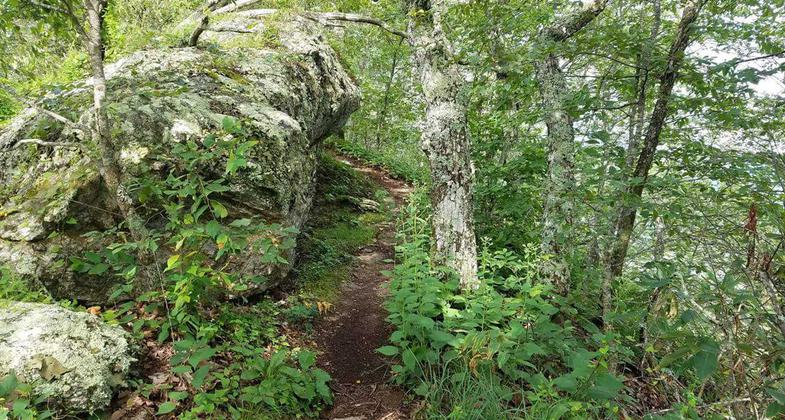
July 2017 hike to the highest point in Georgia (USA), Brasstown Bald Mountain. Photo by Kelly Carter.
July 2017 hike to the highest point in Georgia (USA), Brasstown Bald Mountain. Photo by Kelly Carter.
July 2017 hike to the highest point in Georgia (USA), Brasstown Bald Mountain. Photo by Kelly Carter.
July 2017 hike to the highest point in Georgia (USA), Brasstown Bald Mountain. Photo by Kelly Carter.
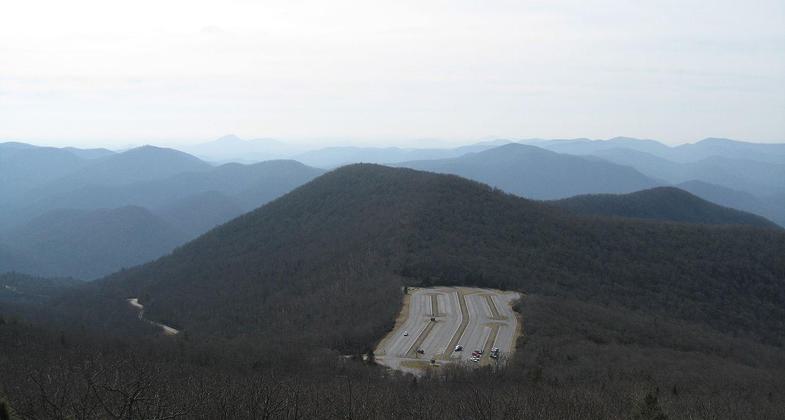
View of Brasstown Bald parking lot from summit. Photo by wiki.
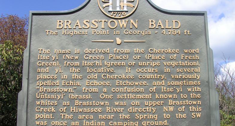
This state historical marker is located on the hiking trail near the summit of Brasstown Bald. Photo by GLadner/wiki.
Location: Northeast Georgia, In the Chattahoochee National Forest, connects Trap Rock Gap to Brasstown Bald.
- States: Georgia
- Counties: Union
The trail descends along a ridge from Brasstown Bald parking lot to Track Rock Gap. There are ups and downs, some steep along the way. The final mile has several switchbacks. Open ridge tops provide excellent views. This trail is within the Brasstown Wilderness for about five miles of its length. This trail is not blazed.
Accessibility Information
No text provided.
Reviews
Kelly Carter
Rigorous hike, beautiful trail, nice views
My trip was from the lower end of the trail to the summit of Brasstown Bald. The beginning of the trail is very steep, probably the most difficult stage of the hike. By the time you get to the summit, you'll have traveled almost 6 miles (one way) and climbed about 2,500 feet in elevation (actual elevation gain including loss/regain is more). This length and ascent may be too much for hikers not in the best physical shape.
The best views before the summit come right after the really steep part at the beginning. But during the seasons when the trees have full leaf cover, the views are somewhat restricted. Fortunately, this same tree cover makes for a shadier hike when hot and sunny. It's still wise to use sunscreen, but very important to use insect repellent (for flying insects and ticks).
Along the trail, you may encounter a few"social trails" that go a short distance (say, to a clandestine camping spot) the come to a dead end. Just back up and seek the actual trail. The trail will come to a parking lot with several buildings just before the actual summit. There is a relatively short (less than one mile, maybe 1/2 mile or so) paved trail to the summit that is quite steep, but there are several resting places with benches. At the summit, there is a really nice visitor center (not always open, so check the hours).
Advice: back where the shops are, if you hit a time when none of the staffed shops are open, and you want a drink from a vending machine, make sure you have 1-dollar bills, and/or maybe quarters, else you can't buy a drink.
Allowed Uses:
Dogs, on leash Hiking/WalkingOther Activities
- Camping
- Wildlife viewing / observation
Public Contact
Frances MasonChattahoochee-Oconee National Forest
P.O. Box 9
Blairsville, GA 30514
[email protected] • (706) 745-6928
www.fs.fed.us/conf
Contact the trail manager for current maps and visiting details.
More Details
- Elevation (low): 2200
- Elevation (high): 4350
- Elevation (cumulative): --
- Part of a Trail System? No
- Surface (primary): Soil
- Surfaces (additional): Soil
- Tread Width (average): 18"
- Tread Width (minimum): --
- Running length (minimum): --
- Tread Grade (average, percent): 8
- Tread Grade (maximum): 20
- Running length (maximum): --
- Cross-slope (average, percent): --
- Cross-slope (maximum): --
- Running length (maximum): --
- Certified as an NRT
May 31, 1979