Arkansas River Water Trail
check with the trail manager for updated details before visiting.
Arkansas River Water Trail
State
National Water Trail
- Length
192 miles
- Elevation Gain
--
- Route Type
out & back
(1 review)
- Length
192 miles - Elevation Gain
-- - Route Type
out & back
The Arkansas River from Great Bend, Kansas to the Kansas/Oklahoma border provides 192 miles of scenic water trail and riparian corridor wildlife habitat. The river meanders through the expansive prairie, rich pastures, and farmland, passing along many cities and small towns as it goes.
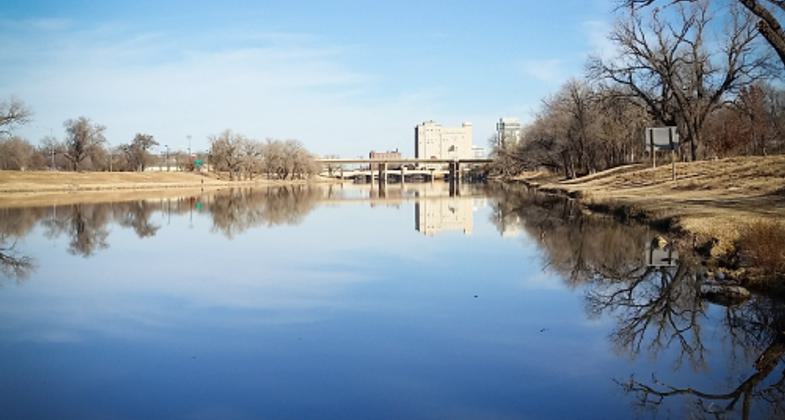
The Wichita skyline from Lincoln Street. Photo by Jessica Mounts
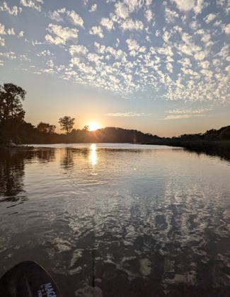
Arkansas near Derby, KS at sunset.
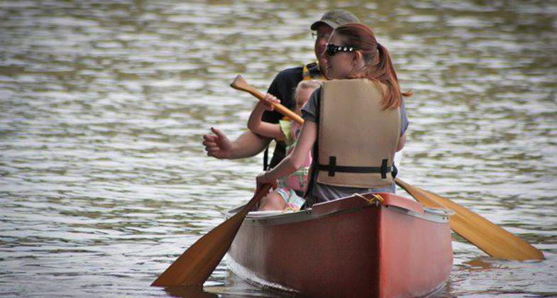
A family canoes on the Arkansas River.

Location: The Arkansas River from Great Bend, Kansas to the Kansas/Oklahoma border
- States: Kansas
- Counties: Barton, Rice, Reno, Sedgwick, Sumner, Cowley
- Cities/Townships: Great Bend, Hutchinson, South Hutchinson, Wichita, Derby, Mulvane, Oxford, Winfield, Arkansas City
A major tributary of the Mississippi River, the Arkansas River generally flows to the east and southeast, through the states of Colorado, Kansas, Oklahoma, and Arkansas. At 1,469 miles long, it is the sixth-longest river in the United States and the second-longest tributary in the Mississippi-Missouri system. The earliest account of this river is to be found in the narratives of the Coronado Expedition of 1540-1541.
Rich with history, the Arkansas River is overflowing with educational and outdoor recreational opportunities. From scenic prairie views to sport fishing, from kayaking to duck and goose hunting, the Arkansas River provides something exciting to visitors of all ages and interests.
The Kansas Department of Wildlife Parks and Tourism (KDWPT), through mutual agreements with multiple parties, has developed this 192 miles of river water trail into a highly sought-after destination for adventure. KDWPT has spent more than 20 years developing access ramps, enhancing conservation programs, and creating awareness of the water trail. Through the many partnerships that have been formed, this river water trail thrives because of the extensive recreation, education, and restoration activities that take place. You can find more details about these activities later in this application.
While the Arkansas River in Kansas stretches from the Colorado border, the westernmost portion of the river rarely holds enough water to navigate. Beginning at Great Bend, the flows of the river begin to reach seasonal flows sufficient for paddling. By nature, prairie streams and rivers are prone to drought and flooding with varied seasonal precipitation.
Accessibility Information
No text provided.
Reviews
Charles Lewis Jr
Arkansas River from Great Bend to Alden 33 miles
My 33 mile over night trip on the Arkansas River Trail was good, bad and in between. The wildlife seen on the river included an eagle, several owls, many deer and an adorable line of baby ducks. There were plenty of sand beaches for camping. I hammock camped but will tent camp next time due to availability of flat sand bars. the run down the river was somewhat challenging due to new debris ( downed trees) in the river from this years extensive flooding. I also took the cheapest kayak you can buy due to its ability to carry gear vs my 20 year old style white water kayak. If you have little to no experience floating rivers I would recommend taking a kayak that is easily maneuverable. I also recommend you get a little experience before attempting to float this river. These recommendations are based on the river conditions I floated under. You can find conditions of the river on a usgs site Great Bend KS.
Conditions on June 10th when I entered the river: water level gauge 4.6 feet. Discharge was 700 cubic feet per second. The river at that water level will create many forks in the river, with most reconnecting back to the main river but some ending in a dead end. I finally reached a turn in the river a couple miles before the first Alden bridge access point where the current was too strong for my cheap kayak to paddle across and it pulled me and the kayak into it which forced me to try and hit a gap of about 4 feet in between a downed tree along the bank and another tree mostly sunk in the water except for 2 large branches sticking out. I flipped and struggled to get to the bank with my Kayak due to the fast current and deepness of the water there. I assessed my situation from that point and decided that the risk was maybe a little too much for me in that particular kayak. The kayak I had was very stable but not maneuverable.
When I got to the first Alden bridge access point I started to walk up to the road I was lucky enough to arrive the same time the land owner was pulling up in his truck. Great guy, Roy ( last name eludes me). He offered to haul me and my kayak to the coop in Alden where I could wait for my ride. Thank you Roy and the crew at the coop for being so accommodating. Learned from these people that people are taking 4 wheelers and doing other illegal stuff through these access points and causing damage to their properties, I hope these problems get resolved so we do not lose the ability to float this river. Driving home back to KC I realized that I am not done with this river, I will be back with my new knowledge of the river and a better kayak. Stay Calm and Float On.
Allowed Uses:
Boating, motorized Boating, human-powered SwimmingOther Activities
- Camping
- Fishing
- Heritage and history
- Hunting
- Wildlife viewing / observation
Public Contact
Jeff ConleyKansas Department of Wildlife, Parks & Tourism
512 SE 25th Ave.
Pratt, KS 67570
[email protected] • (620) 672-0786
More Details
- Elevation (low): --
- Elevation (high): --
- Elevation (cumulative): --
- Part of a Trail System? No
- Surface (primary): --
- Surfaces (additional): Rock, smooth, Water, calm
- Tread Width (average): 0"
- Tread Width (minimum): 0
- Running length (minimum): --
- Tread Grade (average, percent): --
- Tread Grade (maximum):
- Running length (maximum): --
- Cross-slope (average, percent): 0
- Cross-slope (maximum): --
- Running length (maximum): --
- Certified as an NRT
Jun 14, 2016