Arch Rock Trail
This information is a public record of the 1981 NRT application and may be out of date if it has not been updated by a trail manager --
check with the trail manager for updated details before visiting.
check with the trail manager for updated details before visiting.
Arch Rock Trail
USDA Forest Service
Backcountry Trail
- Length
0.3 miles
- Elevation Gain
--
- Route Type
out & back
- Length
0.3 miles - Elevation Gain
-- - Route Type
out & back
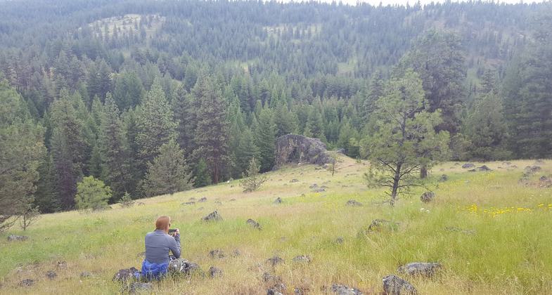
Arch Rock is an ashflow tuff with a scenic arch and several small rockshelters eroded into the outcrop.
Location: In the Malheur NF, 25 mi. from Prairie City. Follow SR 26, Grant Co. Rd. 18, and FS Rds. 36 and 3650.
- States: Oregon
- Counties: Grant
Very scenic, easy, short hike. Very photogenic trail with interesting rock formations. No toilet, Facilities available. Pack it in pack it out.
Accessibility Information
No text provided.
Allowed Uses:
Dogs, on leash Hiking/WalkingOther Activities
- Camping
Public Contact
Robin MurrayForest Service
P.O. Box 849
John Day, OR 97845
(541) 575-3000
Contact the trail manager for current maps and visiting details.
More Details
- Elevation (low): --
- Elevation (high): --
- Elevation (cumulative): --
- Part of a Trail System? No
- Surface (primary): --
- Surfaces (additional): --
- Tread Width (average): 24"
- Tread Width (minimum): --
- Running length (minimum): --
- Tread Grade (average, percent): --
- Tread Grade (maximum):
- Running length (maximum): --
- Cross-slope (average, percent): --
- Cross-slope (maximum): --
- Running length (maximum): --
- Certified as an NRT
Jul 19, 1981