Arcadia Trail
check with the trail manager for updated details before visiting.
Arcadia Trail
USDA Forest Service
Backcountry Trail
- Length
6 miles
- Elevation Gain
--
- Route Type
out & back
- Length
6 miles - Elevation Gain
-- - Route Type
out & back
Because of the notable views it offers, Arcadia Trail has been designated a National Recreation Trail, placing it among the most outstanding trails in the nation.
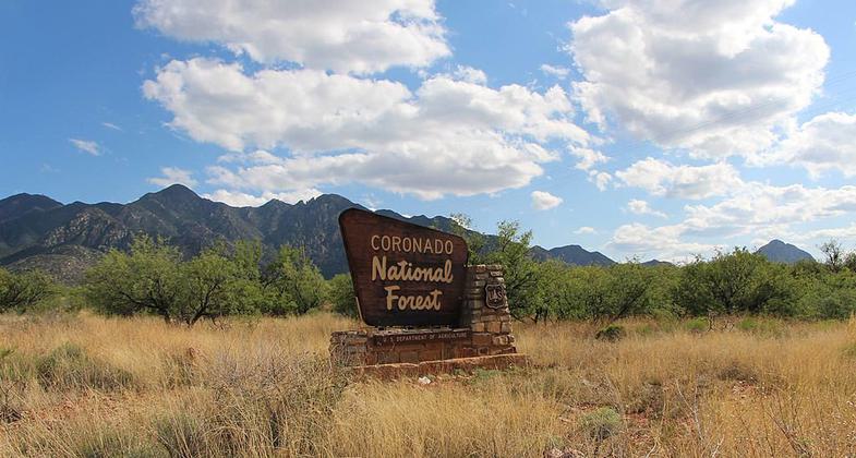
Coronado National Forest. Photo by USFS.

Arcadia Trail after monsoon rains near Eagle Rock at approximately 9300ft.

Coronado National Forest. Photo by Zereshk wiki.
Location: In Coronado National Forest, SW of Safford, accessed at Shannon and Upper Arcadia campgrounds.
- States: Arizona
Most people travel this popular pathway from Shannon Campground to Arcadia because it's mostly downhill in that direction. The course the trail follows winds in and out of stands of trees that are made up mostly of Douglas-fir, Engelmann spruce, and quaking aspen on the upper end changing gradually to ponderosa pine and silverleaf oak on more southern-facing slopes as the trail nears Arcadia Campground. Near the upper trailhead there is an area that has been logged and remains relatively open where you may find some tasty wild raspberries if you come in late summer.
Beyond a series of switchbacks at about a mile from the trailhead, Heliograph Trail #328A climbs to the top of Heliograph Peak where the rugged landscape of southeastern Arizona forms a sweeping, unbroken panorama. Many who use this trail take this spur and follow the Heliograph Road back to Shannon Camp for a loop of about four miles. As the trail drops toward Arcadia it provides good views of distant peaks and nearby canyons. Just above Arcadia Campground, the trail crosses a small drainage shaded by riparian species such as box elder and bigtooth maple. There are usually some colorful wildflowers here as well. Watch for black bears and white-tailed deer along the trail and for Aberts squirrels scurrying among the trees.
Accessibility Information
No text provided.
Allowed Uses:
Hiking/WalkingPublic Contact
Coronado National Forest300 West Congress St., 6th Floor
Tuscon, AZ 85701
www.fs.usda.gov/coronado
Contact the trail manager for current maps and visiting details.
More Details
- Elevation (low): --
- Elevation (high): --
- Elevation (cumulative): --
- Part of a Trail System? No
- Surface (primary): --
- Surfaces (additional): --
- Tread Width (average): 0"
- Tread Width (minimum): --
- Running length (minimum): --
- Tread Grade (average, percent): --
- Tread Grade (maximum):
- Running length (maximum): --
- Cross-slope (average, percent): --
- Cross-slope (maximum): --
- Running length (maximum): --
- Certified as an NRT
Nov 26, 1979