Apex Trail
check with the trail manager for updated details before visiting.
Apex Trail
City, Town, or County
Frontcountry Trail
- Length
3.3 miles
- Elevation Gain
--
- Route Type
out & back
(2 reviews)
- Length
3.3 miles - Elevation Gain
-- - Route Type
out & back
Historically a wagon road for prospectors heading west, the natural surface multiple use Apex Trail rises from the outskirts of Golden, CO to the top of Lookout Mountain. Recent directional restrictions apply for bicycling, see park signage.

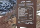
Location: Near Golden in Apex Park, joins Heritage Square Center to the top of Lookout Mountain.
- States: Colorado
- Counties: Jefferson
Historically a wagon road for prospectors heading west, the natural surface multiple-use Apex Trail rises from the outskirts of Golden, Colorado to the top of Lookout Mountain. Recent directional restrictions apply for bicycling, see park signage.
Accessibility Information
No text provided.
Reviews
Randall Stafford
Popular trail with great views
Definitely a popular trail with lots of hikers, but the trail is wide enough in most spots that the crowds aren't an issue. There is a system of alternating mountain biking/ hiking days for half the trails in the park. Today was a hike day, but I did see some mountain bikers on the trails that aren't on the alternating day system. The trail mostly follows a creek with some shade coverage and a large variety of plant life. Great views of Denver from Apex Park and of the Rockies just up on nearby Lookout Mountain.
Matt Culpepper
Apex Trail lollipop
Lollipop hike up the Apex Trail from Heritage Park (east trailhead) to Lookout Mtn Rd. Other half-loop of lollipop is Enchanted Forest Trl. Hike total approximately 6mi and 1300ft. Enjoyable, quaint trail despite mountain bikes and many other hikers. Trail is a steady climb up Lena (Apex) Gulch but not difficult for a Colorado hiker. Several other trails connect from Apex Trl for various combinations of loops, out-and-backs, or lollipops.
Allowed Uses:
Bicycling Dogs, on leash Equestrian Hiking/Walking Snow, snowshoeingOther Activities
- Snow, snow play general
Public Contact
Thea RockJefferson County Open Space, Colorado
700 Jefferson County Parkway
Golden,, CO 80401
(303) 271-5925
Contact the trail manager for current maps and visiting details.
More Details
- Elevation (low): --
- Elevation (high): --
- Elevation (cumulative): --
- Part of a Trail System? No
- Surface (primary): Soil
- Surfaces (additional): Rock, boulders, Rock, crushed, Rock, smooth, Soil
- Tread Width (average): 0"
- Tread Width (minimum): --
- Running length (minimum): --
- Tread Grade (average, percent): --
- Tread Grade (maximum):
- Running length (maximum): --
- Cross-slope (average, percent): --
- Cross-slope (maximum): --
- Running length (maximum): --
- Certified as an NRT
Nov 12, 1978