Ann and Roy Butler Hike & Bike Trail
check with the trail manager for updated details before visiting.
Ann and Roy Butler Hike & Bike Trail
City, Town, or County
Frontcountry Trail
- Length
10 miles
- Elevation Gain
--
- Route Type
out & back
- Length
10 miles - Elevation Gain
-- - Route Type
out & back
Ann and Roy Butler Hike & Bike Trail (formerly called Town Lake Trail) is one of the most natural, fitness-friendly hike and bike paths in an urban area anywhere in the United States.

2020 NRT Photo Contest Winner - Urban Trails and Greenways. Photo by Emma Rogers.

Young anglers along the Ann and Roy Butler Hike and Bike Trail on Ladybird Lake just south of downtown Austin, Texas. Photo by Chris Sheffield.
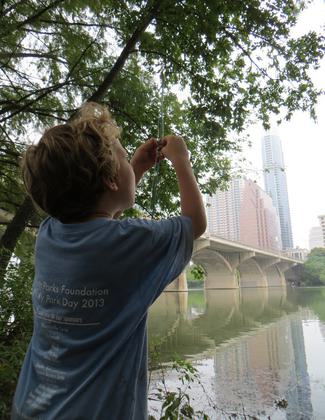
A young angler along the Ann and Roy Butler Hike and Bike Trail on Ladybird Lake in downtown Austin, Texas. Photo by Chris Sheffield.

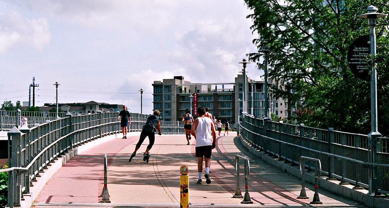
Photo by R. E. Martin.

Historic Lamar Blvd. Bridge with new bridge parallel to it. Photo by R. E. Martin.


Location: On both sides of the lake in downtown Austin, TX, in Austin's Town Lake Park.
- States: Texas
- Counties: Travis
The trail bisects the center of downtown and is surrounded by 10 miles of hiking and biking trails, with access to parks, nature centers, and wilderness preserves.
It's Austin's most memorable tourist attraction and Central Texas' link between north and south and east and west. The Trail is the central meeting point for recreation, concerts, fairs, the arts, and family gatherings. With its diverse and unifying role, the park is a critical ingredient to what makes Austin a "livable" city and is a key element of what makes Austinites proud to call this city home.
The scenic downtown location along the linear lake has lots of use. Millions of bats live under major bridge crossing over the trail. This was the site of the 2004 National Trails Symposium.
Accessibility Information
No text provided.
Allowed Uses:
Dogs, on leash Hiking/WalkingOther Activities
- Fishing
Public Contact
Susan RankinThe Trail Foundation
P.O. Box 5195
Austin, TX 78763
[email protected] • (855) 448-7245
www.thetrailfoundation.org
Contact the trail manager for current maps and visiting details.
More Details
- Elevation (low): 434
- Elevation (high): 450
- Elevation (cumulative): --
- Part of a Trail System? No
- Surface (primary): Rock, crushed
- Surfaces (additional): Rock, crushed
- Tread Width (average): 127"
- Tread Width (minimum): --
- Running length (minimum): --
- Tread Grade (average, percent): 3
- Tread Grade (maximum): 5
- Running length (maximum): --
- Cross-slope (average, percent): --
- Cross-slope (maximum): --
- Running length (maximum): --
- Certified as an NRT
Dec 1, 1975