Alum Cove Natural Bridge Trail
This information is a public record of the 1979 NRT application and may be out of date if it has not been updated by a trail manager --
check with the trail manager for updated details before visiting.
check with the trail manager for updated details before visiting.
Alum Cove Natural Bridge Trail
USDA Forest Service
Backcountry Trail
- Length
1.1 miles
- Elevation Gain
--
- Route Type
Loop
- Length
1.1 miles - Elevation Gain
-- - Route Type
Loop
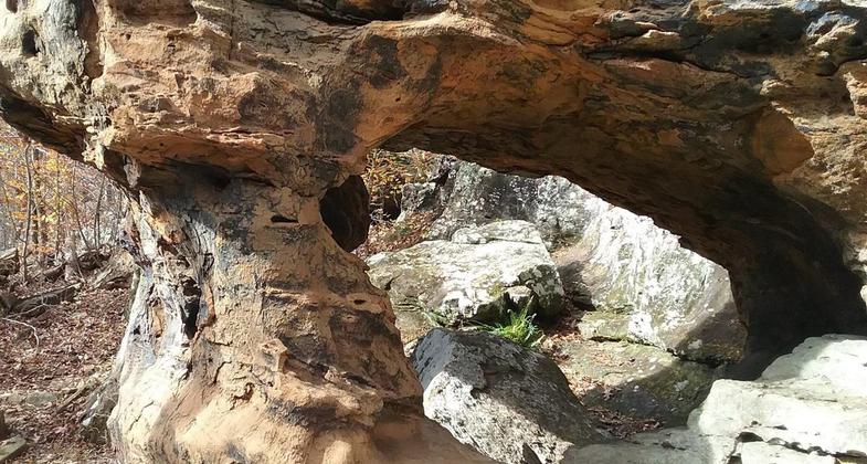
Loop trail that passes a nice bluff line and one of the largest natural rock bridges in this part of the country.


Location: Deer, Alum Cove Natural Bridge Recreation Area.
- States: Arkansas
- Counties: Newton
Unusual rock formations along the bluffs, stands of American beech and other hardwoods, wild magnolias, streams, free roaming goats. One of the largest natural rock bridges in this part of the country.
Accessibility Information
No text provided.
Allowed Uses:
Hiking/WalkingOther Activities
- Wildlife viewing / observation
Public Contact
Richard BowieUS Forest Service
605 west Man Street
Russellville, AR 72801
[email protected] • (501) 964-7236
Contact the trail manager for current maps and visiting details.
More Details
- Elevation (low): 1200
- Elevation (high): 1200
- Elevation (cumulative): --
- Part of a Trail System? No
- Surface (primary): Soil
- Surfaces (additional): --
- Tread Width (average): 24"
- Tread Width (minimum): --
- Running length (minimum): --
- Tread Grade (average, percent): 5
- Tread Grade (maximum): 10
- Running length (maximum): --
- Cross-slope (average, percent): --
- Cross-slope (maximum): --
- Running length (maximum): --
- Certified as an NRT
Nov 15, 1979