Algonkian Regional Park Sanctuary Trail
This information is a public record of the 2004 NRT application and may be out of date if it has not been updated by a trail manager --
check with the trail manager for updated details before visiting.
check with the trail manager for updated details before visiting.
Algonkian Regional Park Sanctuary Trail
City, Town, or County
Backcountry Trail
- Length
2 miles
- Elevation Gain
--
- Route Type
out & back
- Length
2 miles - Elevation Gain
-- - Route Type
out & back
The Algonkian Regional Park Sanctuary Trail in Sterling, VA is a 2-mile loop trail through a 30+ acre section of wetlands on Lowe's Island adjacent to the Potomac River.
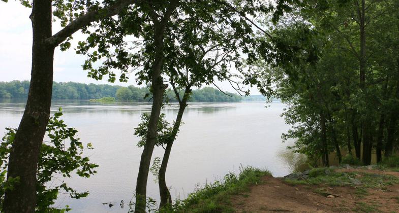
The Potomac River at Algonkian Regional Park. Photo by Jim Northrup Creative Commons.

Location: Lowe's Island
- States: Virginia
- Counties: Loudoun
The Algonkian Regional Park Sanctuary Trail in Sterling, VA is a 2-mile loop trail through a 30+ acre section of wetlands on Lowe's Island adjacent to the Potomac River. This trail is a spur of the multi-jurisdictional Potomac Heritage Trail and will eventually include observation platforms interpretive signage and observation wildlife blinds. The wetlands are a unique part of the Potomac that supports a variety of flora and fauna including Bald Eagles.
Accessibility Information
No text provided.
Allowed Uses:
Hiking/WalkingOther Activities
- Wildlife viewing / observation
Public Contact
Jill Vanden HeuvelNorthern Virginia Regional Park Authority
47001 Fairway Dr.
Sterling, VA 20165
[email protected] • (703) 450-4655
www.nvrpa.org
Contact the trail manager for current maps and visiting details.
More Details
- Elevation (low): --
- Elevation (high): --
- Elevation (cumulative): --
- Part of a Trail System? No
- Surface (primary): Soil
- Surfaces (additional): Soil
- Tread Width (average): 30"
- Tread Width (minimum): --
- Running length (minimum): --
- Tread Grade (average, percent): 5
- Tread Grade (maximum): 20
- Running length (maximum): --
- Cross-slope (average, percent): --
- Cross-slope (maximum): --
- Running length (maximum): --
- Certified as an NRT
Jun 1, 2004