Alabama State Lands Bartram Canoe Trail
check with the trail manager for updated details before visiting.
Alabama State Lands Bartram Canoe Trail
State
Water Trail (other)
- Length
154 miles
- Elevation Gain
--
- Route Type
Loop
- Length
154 miles - Elevation Gain
-- - Route Type
Loop
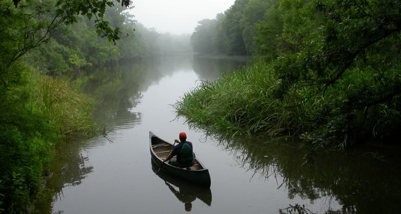
The Bartram Canoe Trail system provides opportunities for recreational boaters, specifically canoes and kayakers, to enjoy the rivers, streams, lakes, sloughs and bayous of the Delta.
Location: Located in the Mobile-Tensaw Delta in Baldwin County.
- States: Alabama
- Counties: Baldwin
The Mobile-Tensaw Delta is our nation's second largest river delta. It encompasses a vast wetland characterized by estuarine marsh, cypress-tupelo swamp, and bottomland hardwood ecosystem. The Delta has over 50 rare and endangered plant and animal species known to inhabit its wetlands and waterways. The region encompasses over 250,000 acres, of which over 100,000 are publicly owned and managed. In January 2003 the Alabama State Lands Division of the Alabama Department of Conservation and Natural Resources implemented the Alabama State Lands Bartram Canoe Trail system which provides opportunities for recreational boaters, specifically canoeists and kayakers, to enjoy the rivers, streams, lakes, sloughs, and bayous of the Delta.
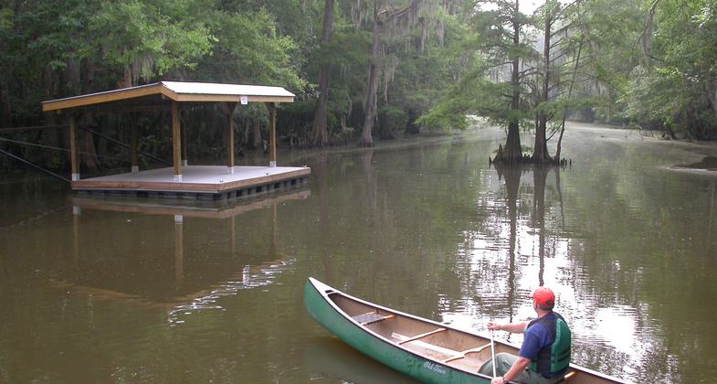
Currently, the Alabama State Lands Division maintains six day-use trails and six overnight trails. There are two land-based campsites and four floating platform campsites available for the overnight routes. The land-based camping areas are open to anyone on a first-come-first-served basis. The floating platform campsites are limited to groups no larger than eight and are available by reservation only. Reservations are limited to canoeists and kayakers. Motorized vessels are prohibited at campsites. For more information about reservations, trip planning, rules of use, or fees, go to www.bartramcanoetrail.com.
Accessibility Information
No text provided.
Allowed Uses:
Boating, human-powered SwimmingOther Activities
- Camping
- Fishing
- Heritage and history
- Hunting
- Wildlife viewing / observation
Public Contact
Hank BurchAL Dept of Conservation and Natural Resources
30945 Five Rivers Blvd.
Spanish Fort, AL 36527
[email protected] • (251) 625-0814
www.alabamacanoetrails.com/bartram
More Details
- Elevation (low): --
- Elevation (high): --
- Elevation (cumulative): --
- Part of a Trail System? No
- Surface (primary): Water, slow moving
- Surfaces (additional): Water, slow moving, Water, calm
- Tread Width (average): 0"
- Tread Width (minimum): 0
- Running length (minimum): --
- Tread Grade (average, percent): --
- Tread Grade (maximum):
- Running length (maximum): --
- Cross-slope (average, percent): 0
- Cross-slope (maximum): --
- Running length (maximum): --
- Certified as an NRT
May 29, 2012